Great Missenden night lights from space
Night Light of Great Missenden (England) from space (United Kingdom) Src. Average luminocity for 10x10km area is 3.7241% and for 50x50km: 24.6425%.
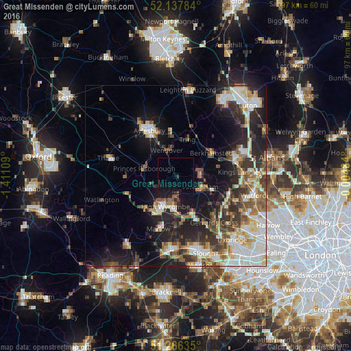
Analysis of Great Missenden night lights 2016
Square area 10x10 km:
 0%
0%90-99
0%80-89
0%70-79
0%60-69
0.28%50-59
0%40-49
0.7%30-39
0.14%20-29
0.14%10-19
8.54%0-9
90.2%Square area 50x50 km:
4.23%90-99
5.28%80-89
2.8%70-79
2.41%60-69
2.93%50-59
3.43%40-49
3.49%30-39
4.04%20-29
7.25%10-19
11.94%0-9
52.2%Clear (daylight) street map image can be seen on geolist.org.
Map coordinates:
52° 8' 16.2" North, 1° 24' 39.9" West
51° 42' 15.1" North, 0° 42' 28.7" West
51° 15' 58.9" North, 0° 0' 17.4" West
Some cities around Great Missenden sort by population:
• High Wycombe
8.8 km =5.5 mi,  198°
198°
• Amersham
7.6 km =4.7 mi,  123°
123°
• Chesham
7.5 km =4.7 mi,  93°
93°
• Amersham on the Hill
7.7 km =4.8 mi, 115°
• Beaconsfield
11.1 km =6.9 mi,  157°
157°
• Tring
10.6 km =6.6 mi,  18°
18°
• Princes Risborough
8.8 km =5.5 mi,  285°
285°
• Wendover
6.8 km =4.2 mi,  341°
341°
2648057 (p: 7,227)
Sources (retrieved 2019-11-25):
» Earth at Night: Flat Maps 2012, 2016