Stourport-on-Severn night lights from space
Night Light of Stourport-on-Severn (England) from space (United Kingdom) Src. Average luminocity for 10x10km area is 16.7828% and for 50x50km: 17.5543%.
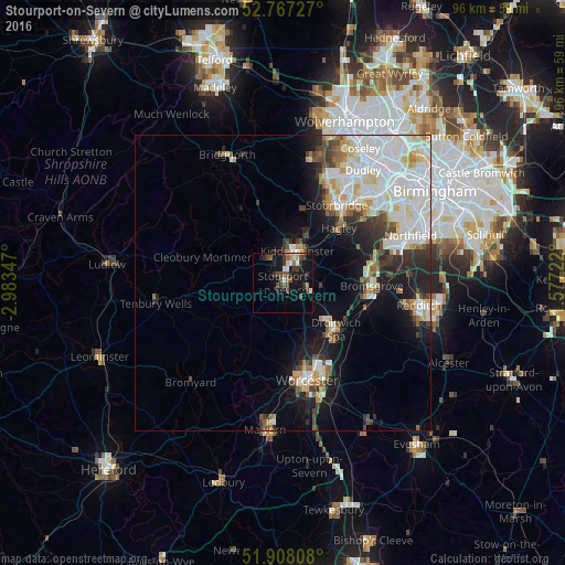
Analysis of Stourport-on-Severn night lights 2016
Square area 10x10 km:
 1.64%
1.64%90-99
1.89%80-89
1.01%70-79
1.14%60-69
1.52%50-59
4.29%40-49
5.3%30-39
4.04%20-29
2.9%10-19
16.79%0-9
59.47%Square area 50x50 km:
4.73%90-99
4.96%80-89
1.64%70-79
1.38%60-69
1.41%50-59
1.38%40-49
1.78%30-39
1.86%20-29
3.17%10-19
7.19%0-9
70.5%Clear (daylight) street map image can be seen on geolist.org.
Map coordinates:
52° 46' 2.2" North, 2° 59' 0.5" West
52° 20' 23.1" North, 2° 16' 49.2" West
51° 54' 29.1" North, 1° 34' 38" West
Some cities around Stourport-on-Severn sort by population:
• Worcester
17.2 km =10.7 mi,  166°
166°
• Kidderminster
5.8 km =3.6 mi,  20°
20°
• Bromsgrove
15 km =9.3 mi,  91°
91°
• Droitwich
12 km =7.5 mi,  132°
132°
• Kingswinford
19.1 km =11.9 mi, 23°
• Bewdley
4.8 km =3 mi,  327°
327°
• Hagley
14.1 km =8.8 mi,  47°
47°
• Barnt Green
18.7 km =11.6 mi,  83°
83°
2636767 (p: 20,586)
Sources (retrieved 2019-11-25):
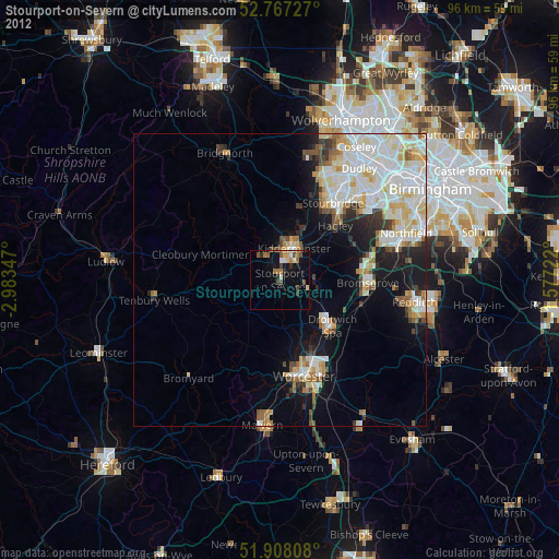
» Earth at Night: Flat Maps 2012, 2016