Fareham night lights from space
Night Light of Fareham (England) from space (United Kingdom) Src. Average luminocity for 10x10km area is 38.5448% and for 50x50km: 13.4628%.
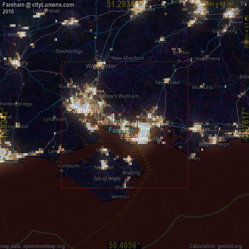
Analysis of Fareham night lights 2016
Square area 10x10 km:
 2.8%
2.8%90-99
5.74%80-89
2.94%70-79
4.2%60-69
5.46%50-59
7.7%40-49
8.54%30-39
15.27%20-29
13.03%10-19
31.65%0-9
2.66%Square area 50x50 km:
1.83%90-99
2.25%80-89
0.87%70-79
1.3%60-69
1.79%50-59
2.2%40-49
2.56%30-39
3.09%20-29
4.12%10-19
9.03%0-9
70.95%Clear (daylight) street map image can be seen on geolist.org.
Map coordinates:
51° 17' 36.3" North, 1° 52' 56.7" West
50° 51' 5.8" North, 1° 10' 45.4" West
50° 24' 20.2" North, 0° 28' 34.2" West
Some cities around Fareham sort by population:
• Portsmouth
8.5 km =5.3 mi,  133°
133°
• Gosport
7.2 km =4.5 mi,  150°
150°
• Waterlooville
10.9 km =6.8 mi,  72°
72°
• Southsea
9.3 km =5.8 mi,  135°
135°
• Cosham
8.2 km =5.1 mi,  93°
93°
• Lee-on-the-Solent
5.8 km =3.6 mi,  195°
195°
• Bursledon
10.3 km =6.4 mi,  292°
292°
• Denmead
9.8 km =6.1 mi,  53°
53°
2649692 (p: 57,390)
Sources (retrieved 2019-11-25):
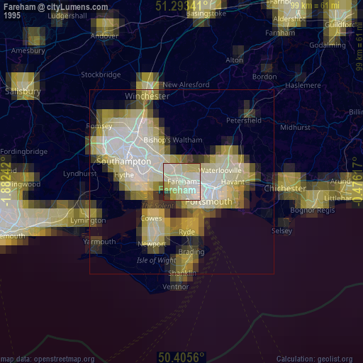
» NASA, Earths city lights 1995
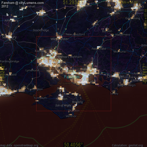
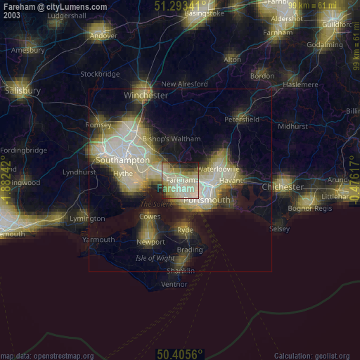
» NASA city lights 2003
» Earth at Night: Flat Maps 2012, 2016