Fallowfield night lights from space
Night Light of Fallowfield (England) from space (United Kingdom) Src. Average luminocity for 10x10km area is 98.3889% and for 50x50km: 38.9787%.
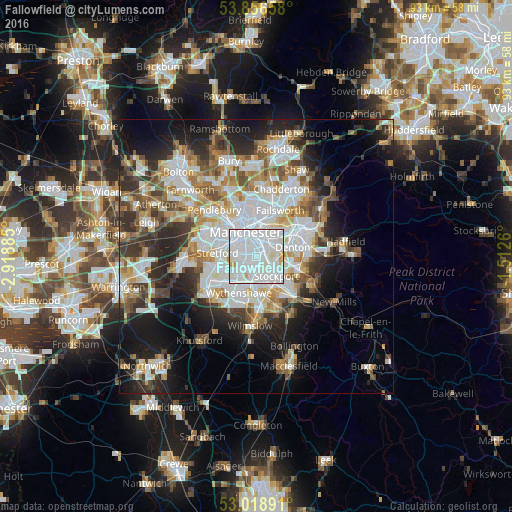
Analysis of Fallowfield night lights 2016
Square area 10x10 km:
 65.48%
90-99
30.03%80-89
2.51%70-79
1.98%60-69
0%50-59
0%40-49
0%30-39
0%20-29
0%10-19
0%0-9
0%Square area 50x50 km:
10.82%90-99
8.54%80-89
3.92%70-79
4.02%60-69
4.65%50-59
4.41%40-49
4.41%30-39
4.92%20-29
8.27%10-19
12.45%0-9
33.57%Clear (daylight) street map image can be seen on geolist.org.
Map coordinates:
53° 51' 23.7" North, 2° 55' 7.9" West
53° 26' 23.3" North, 2° 12' 56.6" West
53° 1' 8.1" North, 1° 30' 45.4" West
Some cities around Fallowfield sort by population:
• Manchester
4.8 km =3 mi,  342°
342°
• Stockport
5.1 km =3.2 mi,  130°
130°
• Denton
6.7 km =4.2 mi,  73°
73°
• Droylsden
6.5 km =4 mi,  46°
46°
• Longsight
2.2 km =1.4 mi,  25°
25°
• Didsbury
2.7 km =1.7 mi,  202°
202°
• Burnage
1.3 km =0.8 mi, 126°
• Hulme
3.6 km =2.2 mi,  322°
322°
6691252 (p: 14,132)
Sources (retrieved 2019-11-25):
» Earth at Night: Flat Maps 2012, 2016