Manchester night lights from space
Night Light of Manchester (England) from space (United Kingdom) Src. Average luminocity for 10x10km area is 98.7963% and for 50x50km: 39.8593%.
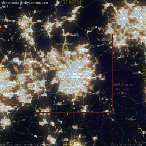
Analysis of Manchester night lights 2016
Square area 10x10 km:
 77.51%
90-99
18.25%80-89
3.84%70-79
0.4%60-69
0%50-59
0%40-49
0%30-39
0%20-29
0%10-19
0%0-9
0%Square area 50x50 km:
10.84%90-99
8.56%80-89
3.82%70-79
4.16%60-69
4.79%50-59
4.55%40-49
4.71%30-39
5.39%20-29
8.4%10-19
14.29%0-9
30.49%Clear (daylight) street map image can be seen on geolist.org.
Map coordinates:
53° 53' 50.3" North, 2° 56' 26" West
53° 28' 51.4" North, 2° 14' 14.7" West
53° 3' 37.7" North, 1° 32' 3.5" West
Some cities around Manchester sort by population:
• Salford
3.6 km =2.2 mi,  282°
282°
• Failsworth
5.4 km =3.4 mi,  60°
60°
• Longsight
3.5 km =2.2 mi,  136°
136°
• Fallowfield
4.8 km =3 mi,  162°
162°
• Cheetham Hill
2 km =1.2 mi,  358°
358°
• Crumpsall
4.2 km =2.6 mi,  353°
353°
• Blackley
4.4 km =2.7 mi,  20°
20°
• Hulme
1.9 km =1.2 mi,  204°
204°
2643123 (p: 395,515)
Sources (retrieved 2019-11-25):
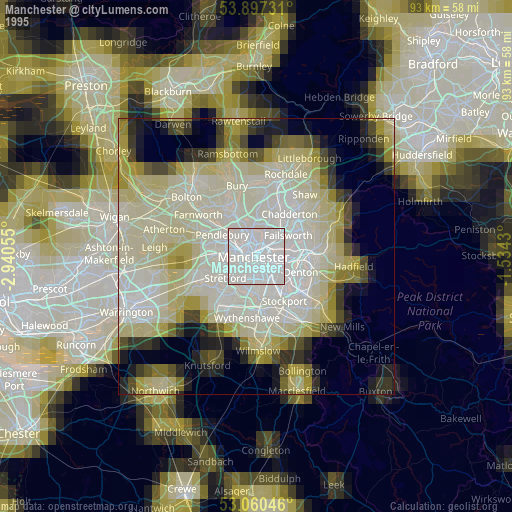
» NASA, Earths city lights 1995
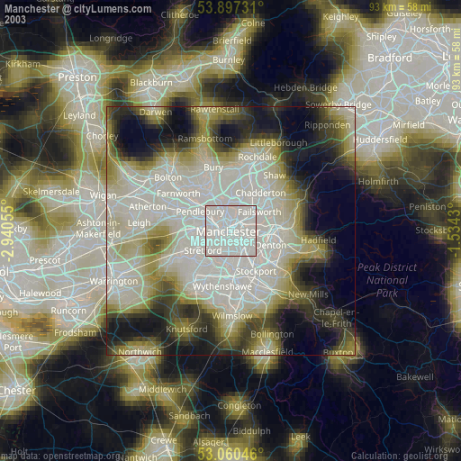
» NASA city lights 2003
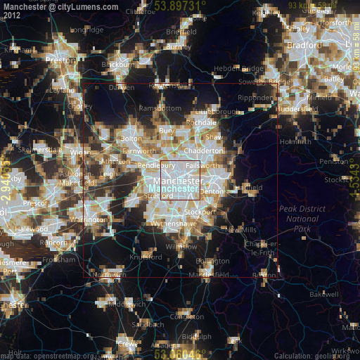
» Earth at Night: Flat Maps 2012, 2016