Hulme night lights from space
Night Light of Hulme (England) from space (United Kingdom) Src. Average luminocity for 10x10km area is 98.6931% and for 50x50km: 40.4356%.
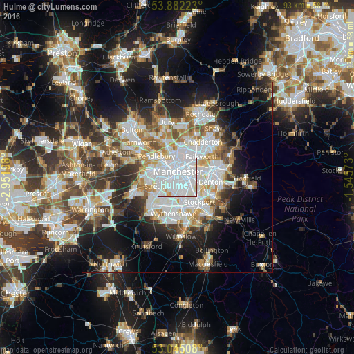
Analysis of Hulme night lights 2016
Square area 10x10 km:
 75.26%
90-99
20.63%80-89
2.78%70-79
1.32%60-69
0%50-59
0%40-49
0%30-39
0%20-29
0%10-19
0%0-9
0%Square area 50x50 km:
11%90-99
8.77%80-89
3.94%70-79
4.23%60-69
4.89%50-59
4.62%40-49
4.74%30-39
5.33%20-29
8.52%10-19
13.96%0-9
30%Clear (daylight) street map image can be seen on geolist.org.
Map coordinates:
53° 52' 56" North, 2° 57' 7.1" West
53° 27' 56.6" North, 2° 14' 55.9" West
53° 2' 42.3" North, 1° 32' 44.6" West
Some cities around Hulme sort by population:
• Manchester
1.9 km =1.2 mi,  24°
24°
• Salford
3.7 km =2.3 mi,  311°
311°
• Stretford
4.8 km =3 mi,  248°
248°
• Longsight
3.3 km =2.1 mi,  105°
105°
• Didsbury
5.5 km =3.4 mi,  167°
167°
• Fallowfield
3.6 km =2.2 mi,  142°
142°
• Burnage
4.9 km =3 mi, 138°
• Cheetham Hill
3.7 km =2.3 mi,  10°
10°
6691257 (p: 8,932)
Sources (retrieved 2019-11-25):
» Earth at Night: Flat Maps 2012, 2016