Denton night lights from space
Night Light of Denton (England) from space (United Kingdom) Src. Average luminocity for 10x10km area is 89.328% and for 50x50km: 35.434%.
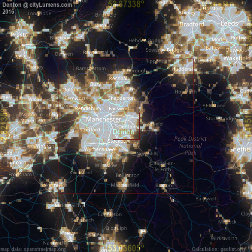

Analysis of Denton night lights 2016
Square area 10x10 km:
 37.17%
90-99
33.2%80-89
11.24%70-79
5.82%60-69
3.84%50-59
2.25%40-49
1.59%30-39
3.31%20-29
1.59%10-19
0%0-9
0%Square area 50x50 km:
10.46%90-99
7.97%80-89
3.46%70-79
3.58%60-69
4.25%50-59
3.83%40-49
3.38%30-39
3.68%20-29
7.11%10-19
11.17%0-9
41.11%Clear (daylight) street map image can be seen on geolist.org.
Map coordinates:
53° 52' 24.2" North, 2° 49' 16.9" West
53° 27' 24.4" North, 2° 7' 5.6" West
53° 2' 9.8" North, 1° 24' 54.4" West
Some cities around Denton sort by population:
• Ashton-under-Lyne
3.8 km =2.4 mi,  19°
19°
• Hyde
2.6 km =1.6 mi,  103°
103°
• Droylsden
3.2 km =2 mi,  325°
325°
• Stalybridge
5 km =3.1 mi,  52°
52°
• Dukinfield
2.8 km =1.7 mi,  44°
44°
• Longsight
5.5 km =3.4 mi,  271°
271°
• Bredbury
4.5 km =2.8 mi,  178°
178°
• Haughton Green
2.2 km =1.4 mi,  142°
142°
2651357 (p: 27,464)
Sources (retrieved 2019-11-25):
» Earth at Night: Flat Maps 2012, 2016