Stockport night lights from space
Night Light of Stockport (England) from space (United Kingdom) Src. Average luminocity for 10x10km area is 88.1958% and for 50x50km: 35.5919%.
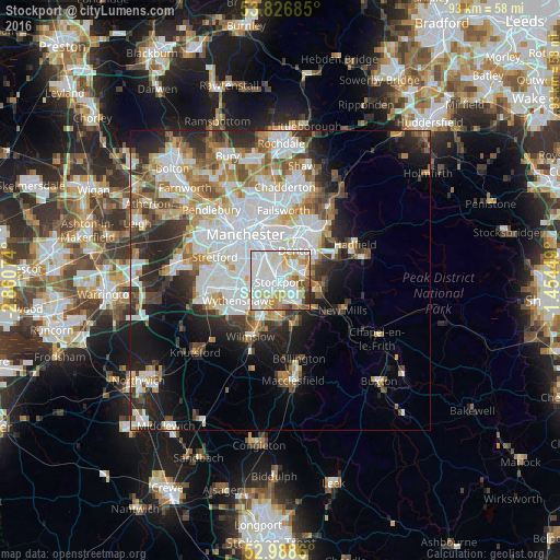
Analysis of Stockport night lights 2016
Square area 10x10 km:
 34.13%
90-99
30.69%80-89
11.38%70-79
8.47%60-69
5.82%50-59
4.5%40-49
2.78%30-39
1.19%20-29
1.06%10-19
0%0-9
0%Square area 50x50 km:
10.62%90-99
8.3%80-89
3.5%70-79
3.6%60-69
4.05%50-59
3.78%40-49
3.65%30-39
3.85%20-29
6.87%10-19
9%0-9
42.77%Clear (daylight) street map image can be seen on geolist.org.
Map coordinates:
53° 49' 36.7" North, 2° 51' 38.7" West
53° 24' 35.2" North, 2° 9' 27.4" West
52° 59' 19" North, 1° 27' 16.2" West
Some cities around Stockport sort by population:
• Cheadle Hulme
4.3 km =2.7 mi,  209°
209°
• Denton
5.8 km =3.6 mi,  26°
26°
• Hazel Grove
4 km =2.5 mi,  137°
137°
• Bredbury
2.8 km =1.7 mi,  74°
74°
• Didsbury
5 km =3.1 mi,  279°
279°
• Fallowfield
5.1 km =3.2 mi,  310°
310°
• Burnage
3.8 km =2.4 mi, 312°
• Haughton Green
5.3 km =3.3 mi,  48°
48°
2636882 (p: 139,052)
Sources (retrieved 2019-11-25):
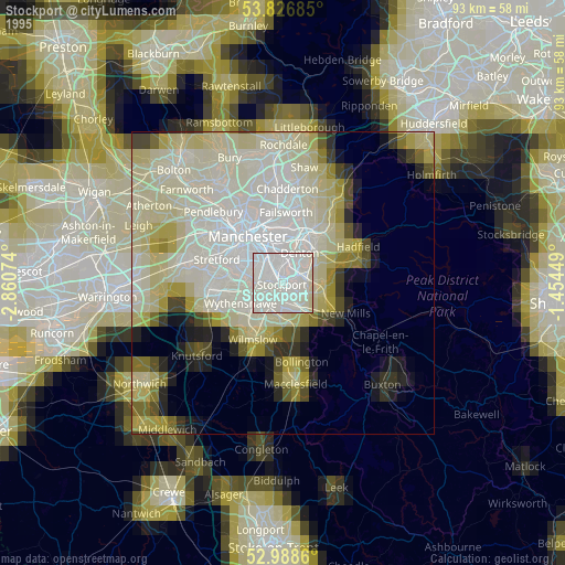
» NASA, Earths city lights 1995
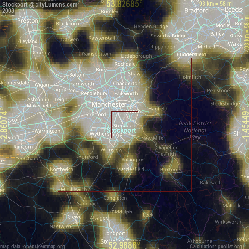
» NASA city lights 2003
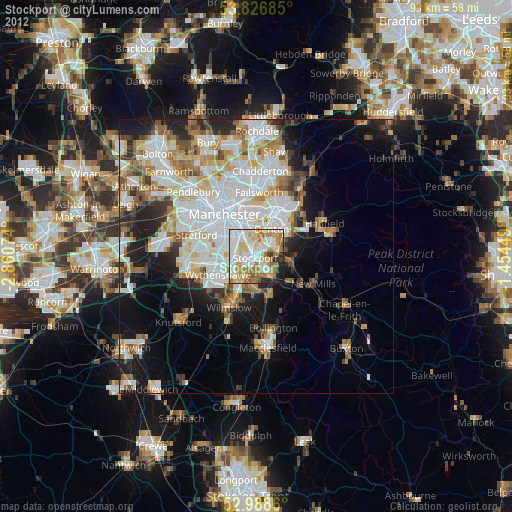
» Earth at Night: Flat Maps 2012, 2016