Ebbw Vale night lights from space
Night Light of Ebbw Vale (Wales) from space (United Kingdom) Src. Average luminocity for 10x10km area is 22.9986% and for 50x50km: 11.7905%.
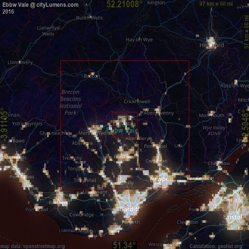
Analysis of Ebbw Vale night lights 2016
Square area 10x10 km:
 0.42%
0.42%90-99
2.52%80-89
1.26%70-79
3.36%60-69
4.2%50-59
3.36%40-49
5.88%30-39
5.04%20-29
3.64%10-19
38.24%0-9
32.07%Square area 50x50 km:
1.32%90-99
1.87%80-89
0.91%70-79
1.33%60-69
1.38%50-59
1.52%40-49
1.76%30-39
2.16%20-29
4.63%10-19
11.46%0-9
71.66%Clear (daylight) street map image can be seen on geolist.org.
Map coordinates:
52° 12' 36.3" North, 3° 54' 39.8" West
51° 46' 37.7" North, 3° 12' 28.5" West
51° 20' 24" North, 2° 30' 17.3" West
Some cities around Ebbw Vale sort by population:
• Brynmawr
3.1 km =1.9 mi,  33°
33°
• Tredegar
2.7 km =1.7 mi,  259°
259°
• Bargoed
10.6 km =6.6 mi,  189°
189°
• Abertillery
7.3 km =4.5 mi,  136°
136°
• Rhymney
5.7 km =3.5 mi,  250°
250°
• Victoria
3.1 km =1.9 mi,  169°
169°
• Crumlin
12.1 km =7.5 mi,  155°
155°
• Blaenavon
8.4 km =5.2 mi,  92°
92°
2650285 (p: 33,068)
Sources (retrieved 2019-11-25):
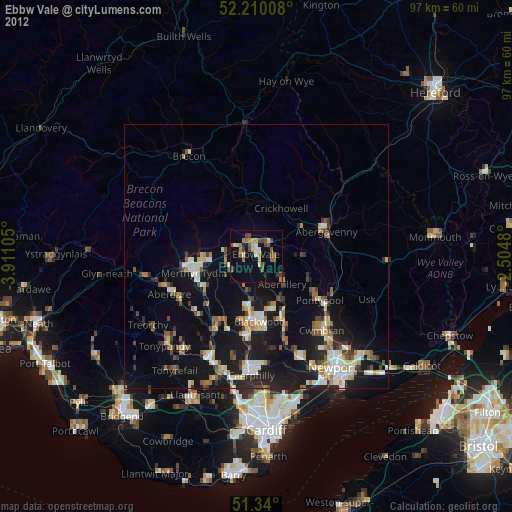
» Earth at Night: Flat Maps 2012, 2016