Bargoed night lights from space
Night Light of Bargoed (Wales) from space (United Kingdom) Src. Average luminocity for 10x10km area is 33.7913% and for 50x50km: 18.0296%.
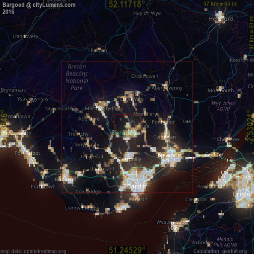
Analysis of Bargoed night lights 2016
Square area 10x10 km:
 1.96%
1.96%90-99
4.9%80-89
5.18%70-79
5.74%60-69
7.84%50-59
4.06%40-49
3.5%30-39
3.08%20-29
9.66%10-19
38.24%0-9
15.83%Square area 50x50 km:
2.88%90-99
3.59%80-89
1.42%70-79
1.97%60-69
1.83%50-59
1.85%40-49
2.3%30-39
2.92%20-29
6.27%10-19
15.01%0-9
59.97%Clear (daylight) street map image can be seen on geolist.org.
Map coordinates:
52° 7' 1.8" North, 3° 56' 11.3" West
51° 40' 60" North, 3° 13' 60" West
51° 14' 43" North, 2° 31' 48.8" West
Some cities around Bargoed sort by population:
• Gelligaer
2.6 km =1.6 mi,  216°
216°
• Blackwood
2.5 km =1.6 mi,  134°
134°
• Nelson
4.9 km =3 mi,  226°
226°
• Treharris
5.5 km =3.4 mi,  247°
247°
• Newbridge
7.1 km =4.4 mi,  105°
105°
• Abercynon
7.7 km =4.8 mi,  236°
236°
• Crumlin
6.8 km =4.2 mi,  95°
95°
• Hengoed
3.6 km =2.2 mi,  178°
178°
2656340 (p: 13,412)
Sources (retrieved 2019-11-25):
» Earth at Night: Flat Maps 2012, 2016