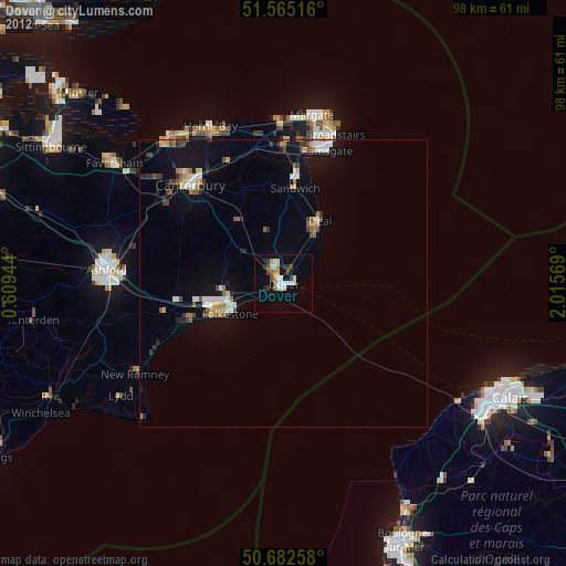
Dover night lights from space
Night Light of Dover (England) from space (United Kingdom) Src. Average luminocity for 10x10km area is 15.8596% and for 50x50km: 4.5909%.
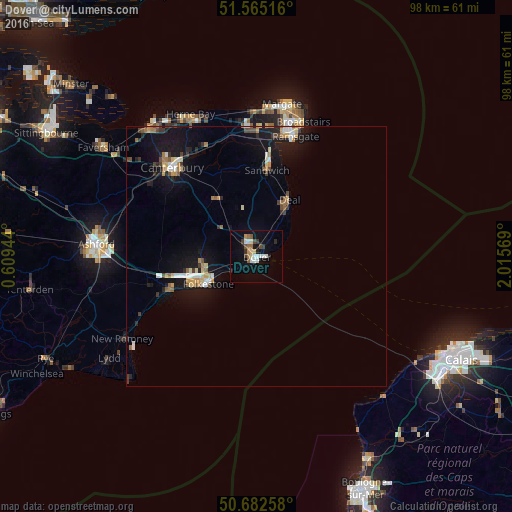
Analysis of Dover night lights 2016
Square area 10x10 km:
 2.94%
2.94%90-99
2.94%80-89
0.94%70-79
1.6%60-69
1.87%50-59
1.47%40-49
1.74%30-39
2.54%20-29
1.2%10-19
9.49%0-9
73.26%Square area 50x50 km:
0.45%90-99
0.64%80-89
0.51%70-79
0.58%60-69
0.53%50-59
0.51%40-49
0.52%30-39
0.64%20-29
0.72%10-19
5.03%0-9
89.89%Clear (daylight) street map image can be seen on geolist.org.
Map coordinates:
51° 33' 54.6" North, 0° 36' 34" East
51° 7' 33.5" North, 1° 18' 45.3" East
50° 40' 57.3" North, 2° 0' 56.5" East
Some cities around Dover sort by population:
• Folkestone
11.3 km =7 mi,  244°
244°
• Canterbury
23.5 km =14.6 mi,  316°
316°
• Ramsgate
24.4 km =15.2 mi,  17°
17°
• Deal
12.6 km =7.8 mi,  30°
30°
• Broadstairs
27.4 km =17 mi, 18°
• Hythe
17.1 km =10.6 mi,  249°
249°
• Hawkinge
10.6 km =6.6 mi,  262°
262°
• Sturry
23.6 km =14.7 mi,  325°
325°
2651048 (p: 41,709)
Sources (retrieved 2019-11-25):
» Earth at Night: Flat Maps 2012, 2016