Canterbury night lights from space
Night Light of Canterbury (England) from space (United Kingdom) Src. Average luminocity for 10x10km area is 20.9706% and for 50x50km: 9.7275%.
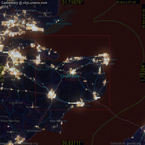
Analysis of Canterbury night lights 2016
Square area 10x10 km:
 2.1%
2.1%90-99
2.8%80-89
3.5%70-79
2.24%60-69
2.24%50-59
1.96%40-49
1.96%30-39
2.1%20-29
5.46%10-19
28.29%0-9
47.34%Square area 50x50 km:
1.15%90-99
1.54%80-89
0.98%70-79
1.24%60-69
1.36%50-59
1.11%40-49
1%30-39
0.99%20-29
1.93%10-19
9.83%0-9
78.88%Clear (daylight) street map image can be seen on geolist.org.
Map coordinates:
51° 43' 0.3" North, 0° 22' 36.4" East
51° 16' 44.5" North, 1° 4' 47.7" East
50° 50' 13.6" North, 1° 46' 58.9" East
Some cities around Canterbury sort by population:
• Ashford
20.6 km =12.8 mi,  224°
224°
• Herne Bay
11 km =6.8 mi,  17°
17°
• Whitstable
9.8 km =6.1 mi,  337°
337°
• Faversham
13.9 km =8.6 mi,  286°
286°
• Birchington-on-Sea
19 km =11.8 mi,  55°
55°
• Hawkinge
19.3 km =12 mi,  162°
162°
• Sturry
3.8 km =2.4 mi,  49°
49°
• Westgate on Sea
21.2 km =13.2 mi, 57°
2653877 (p: 55,240)
Sources (retrieved 2019-11-25):
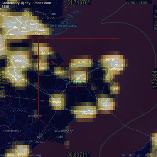
» NASA, Earths city lights 1995
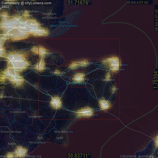
» NASA city lights 2003
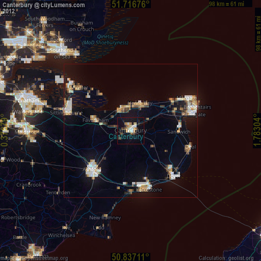
» Earth at Night: Flat Maps 2012, 2016