Darwen night lights from space
Night Light of Darwen (England) from space (United Kingdom) Src. Average luminocity for 10x10km area is 26.0581% and for 50x50km: 34.4968%.
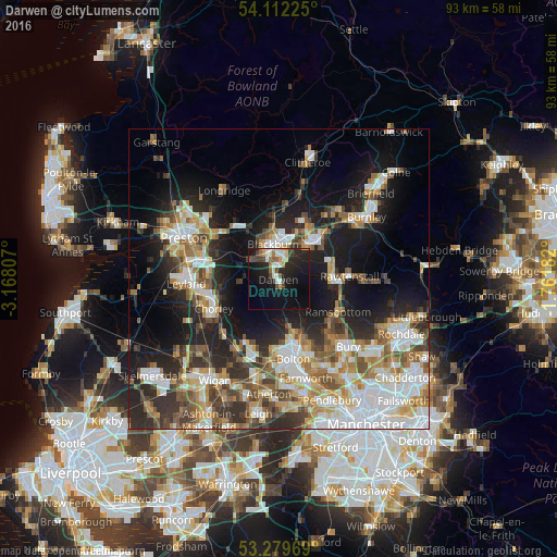
Analysis of Darwen night lights 2016
Square area 10x10 km:
 3.28%
3.28%90-99
4.55%80-89
2.15%70-79
2.53%60-69
1.89%50-59
3.41%40-49
4.04%30-39
2.65%20-29
11.74%10-19
30.3%0-9
33.46%Square area 50x50 km:
7.45%90-99
6.76%80-89
3.24%70-79
4.17%60-69
5.1%50-59
4.55%40-49
4.53%30-39
4.5%20-29
8.78%10-19
15.93%0-9
35%Clear (daylight) street map image can be seen on geolist.org.
Map coordinates:
54° 6' 44.1" North, 3° 10' 5.1" West
53° 41' 52.9" North, 2° 27' 53.8" West
53° 16' 46.9" North, 1° 45' 42.6" West
Some cities around Darwen sort by population:
• Blackburn
5.9 km =3.7 mi,  348°
348°
• Accrington
9.3 km =5.8 mi,  48°
48°
• Chorley
11.3 km =7 mi,  241°
241°
• Ramsbottom
11.2 km =7 mi,  119°
119°
• Haslingden
9.3 km =5.8 mi,  86°
86°
• Great Harwood
10.4 km =6.5 mi,  20°
20°
• Clayton le Moors
9.3 km =5.8 mi,  35°
35°
• Rishton
8.5 km =5.3 mi, 23°
2651495 (p: 32,566)
Sources (retrieved 2019-11-25):
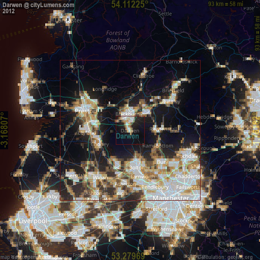
» Earth at Night: Flat Maps 2012, 2016