Weybridge night lights from space
Night Light of Weybridge (England) from space (United Kingdom) Src. Average luminocity for 10x10km area is 54.7773% and for 50x50km: 48.3123%.
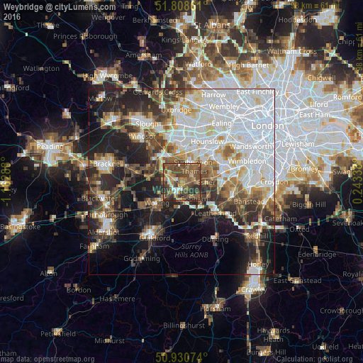
Analysis of Weybridge night lights 2016
Square area 10x10 km:
 4.06%
4.06%90-99
3.5%80-89
4.06%70-79
9.38%60-69
9.94%50-59
23.53%40-49
24.65%30-39
13.73%20-29
7.14%10-19
0%0-9
0%Square area 50x50 km:
16.03%90-99
10.17%80-89
3.68%70-79
4.07%60-69
4.94%50-59
5.78%40-49
6.75%30-39
6.03%20-29
9.52%10-19
13.98%0-9
19.06%Clear (daylight) street map image can be seen on geolist.org.
Map coordinates:
51° 48' 31" North, 1° 9' 46.4" West
51° 22' 18.4" North, 0° 27' 35.1" West
50° 55' 50.7" North, 0° 14' 36.2" East
Some cities around Weybridge sort by population:
• Sunbury-on-Thames
4.6 km =2.9 mi,  38°
38°
• Walton-on-Thames
3.6 km =2.2 mi,  62°
62°
• West Molesey
6.4 km =4 mi, 60°
• Cobham
5.7 km =3.5 mi,  144°
144°
• Addlestone
2.3 km =1.4 mi,  268°
268°
• Chertsey
3.8 km =2.4 mi,  298°
298°
• Shepperton
2.7 km =1.7 mi,  15°
15°
• West Byfleet
5 km =3.1 mi,  220°
220°
2634204 (p: 19,463)
Sources (retrieved 2019-11-25):
» Earth at Night: Flat Maps 2012, 2016