Bungay night lights from space
Night Light of Bungay (England) from space (United Kingdom) Src. Average luminocity for 10x10km area is 1.1073% and for 50x50km: 5.5081%.
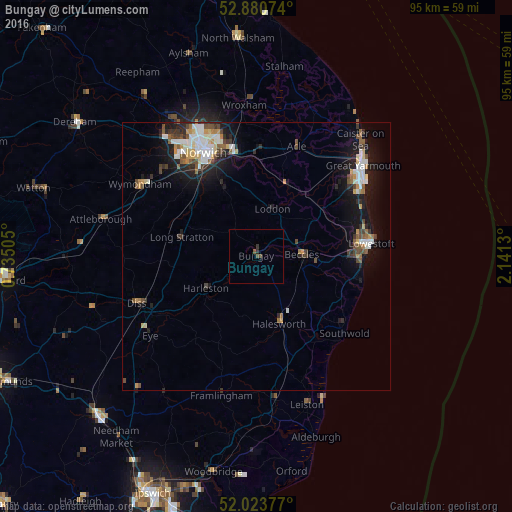
Analysis of Bungay night lights 2016
Square area 10x10 km:
 0%
0%90-99
0%80-89
0%70-79
0%60-69
0%50-59
0.51%40-49
1.01%30-39
0.51%20-29
0.51%10-19
0%0-9
97.47%Square area 50x50 km:
0.93%90-99
1.01%80-89
0.46%70-79
0.61%60-69
0.43%50-59
0.79%40-49
0.88%30-39
0.71%20-29
1.32%10-19
4.35%0-9
88.5%Clear (daylight) street map image can be seen on geolist.org.
Map coordinates:
52° 52' 50.7" North, 0° 44' 6.2" East
52° 27' 15.6" North, 1° 26' 17.4" East
52° 1' 25.6" North, 2° 8' 28.7" East
Some cities around Bungay sort by population:
• Norwich
21.5 km =13.4 mi,  333°
333°
• Lowestoft
21.4 km =13.3 mi,  83°
83°
• Beccles
8.6 km =5.3 mi,  86°
86°
• Bradwell
22.1 km =13.7 mi,  53°
53°
• Thorpe Hamlet
21.1 km =13.1 mi,  336°
336°
• Brundall
18.9 km =11.7 mi,  359°
359°
• Halesworth
12.8 km =8 mi,  159°
159°
• Poringland
13.9 km =8.6 mi, 334°
2654327 (p: 5,127)
Sources (retrieved 2019-11-25):
» Earth at Night: Flat Maps 2012, 2016