Lowestoft night lights from space
Night Light of Lowestoft (England) from space (United Kingdom) Src. Average luminocity for 10x10km area is 16.6124% and for 50x50km: 2.3268%.
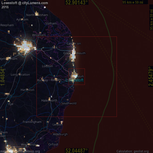
Analysis of Lowestoft night lights 2016
Square area 10x10 km:
 1.52%
1.52%90-99
2.02%80-89
0.38%70-79
2.15%60-69
1.89%50-59
4.17%40-49
4.92%30-39
3.28%20-29
2.4%10-19
12.25%0-9
65.03%Square area 50x50 km:
0.3%90-99
0.33%80-89
0.12%70-79
0.24%60-69
0.25%50-59
0.4%40-49
0.4%30-39
0.32%20-29
0.41%10-19
2.48%0-9
94.76%Clear (daylight) street map image can be seen on geolist.org.
Map coordinates:
52° 54' 5.1" North, 1° 2' 54.7" East
52° 28' 30.8" North, 1° 45' 6" East
52° 2' 41.5" North, 2° 27' 17.2" East
Some cities around Lowestoft sort by population:
• Great Yarmouth
14.9 km =9.3 mi,  354°
354°
• Beccles
12.8 km =8 mi,  262°
262°
• Bradwell
11.5 km =7.1 mi,  342°
342°
• Caister-on-Sea
19.3 km =12 mi, 354°
• Gorleston-on-Sea
11 km =6.8 mi, 352°
• Halesworth
22.1 km =13.7 mi,  229°
229°
• Hemsby
25 km =15.5 mi, 350°
• Bungay
21.4 km =13.3 mi, 263°
2643490 (p: 70,945)
Sources (retrieved 2019-11-25):
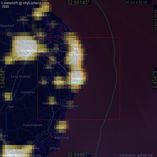
» NASA, Earths city lights 1995
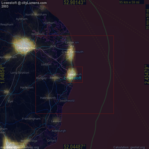
» NASA city lights 2003
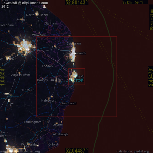
» Earth at Night: Flat Maps 2012, 2016