Beccles night lights from space
Night Light of Beccles (England) from space (United Kingdom) Src. Average luminocity for 10x10km area is 2.0707% and for 50x50km: 5.1167%.
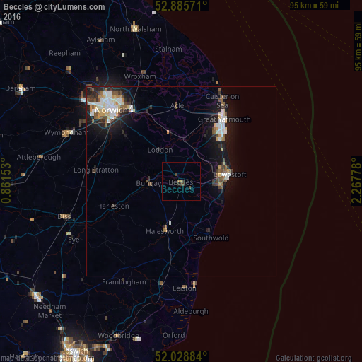
Analysis of Beccles night lights 2016
Square area 10x10 km:
 0%
0%90-99
0%80-89
0%70-79
0.51%60-69
0.51%50-59
0%40-49
1.14%30-39
1.39%20-29
0.51%10-19
0.38%0-9
95.58%Square area 50x50 km:
0.91%90-99
0.97%80-89
0.42%70-79
0.5%60-69
0.4%50-59
0.73%40-49
0.74%30-39
0.67%20-29
1.39%10-19
4.17%0-9
89.09%Clear (daylight) street map image can be seen on geolist.org.
Map coordinates:
52° 53' 8.6" North, 0° 51' 41.5" East
52° 27' 33.7" North, 1° 33' 52.7" East
52° 1' 43.8" North, 2° 16' 4" East
Some cities around Beccles sort by population:
• Lowestoft
12.8 km =8 mi,  82°
82°
• Great Yarmouth
20 km =12.4 mi,  34°
34°
• Bradwell
15.6 km =9.7 mi,  35°
35°
• Brundall
20.3 km =12.6 mi,  334°
334°
• Gorleston-on-Sea
16.9 km =10.5 mi, 41°
• Halesworth
13.2 km =8.2 mi,  198°
198°
• Poringland
18.9 km =11.7 mi,  309°
309°
• Bungay
8.6 km =5.3 mi,  266°
266°
2656067 (p: 13,868)
Sources (retrieved 2019-11-25):
» Earth at Night: Flat Maps 2012, 2016