Kingston upon Hull night lights from space
Night Light of Kingston upon Hull (England) from space (United Kingdom) Src. Average luminocity for 10x10km area is 69.3018% and for 50x50km: 13.2253%.
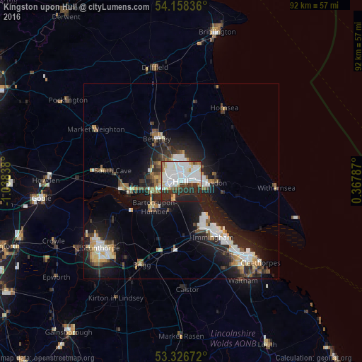
Analysis of Kingston upon Hull night lights 2016
Square area 10x10 km:
 25.51%
90-99
25%80-89
6.06%70-79
2.4%60-69
1.39%50-59
4.42%40-49
2.27%30-39
8.08%20-29
17.42%10-19
7.45%0-9
0%Square area 50x50 km:
2.51%90-99
2.78%80-89
1.11%70-79
1.12%60-69
1.12%50-59
1.58%40-49
1.37%30-39
1.88%20-29
4.94%10-19
9.65%0-9
71.93%Clear (daylight) street map image can be seen on geolist.org.
Map coordinates:
54° 9' 30.1" North, 1° 2' 18.2" West
53° 44' 40.6" North, 0° 20' 6.9" West
53° 19' 36.2" North, 0° 22' 4.3" East
Some cities around Kingston upon Hull sort by population:
• Beverley
12.7 km =7.9 mi,  332°
332°
• Brough
15.7 km =9.8 mi,  263°
263°
• Barton upon Humber
9.4 km =5.8 mi,  229°
229°
• Immingham
16.5 km =10.3 mi,  151°
151°
• Hedon
9.1 km =5.7 mi,  93°
93°
• Hornsea
21.5 km =13.4 mi,  30°
30°
• Watton
22.3 km =13.9 mi,  340°
340°
• North Ferriby
11.5 km =7.1 mi, 256°
2645425 (p: 314,018)
Sources (retrieved 2019-11-25):
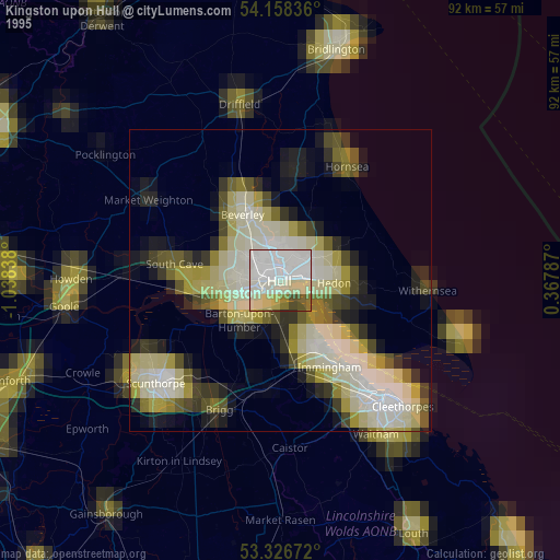
» NASA, Earths city lights 1995
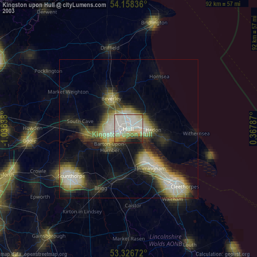
» NASA city lights 2003
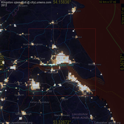
» Earth at Night: Flat Maps 2012, 2016