Brecon night lights from space
Night Light of Brecon (Wales) from space (United Kingdom) Src. Average luminocity for 10x10km area is 1.6111% and for 50x50km: 2.4041%.
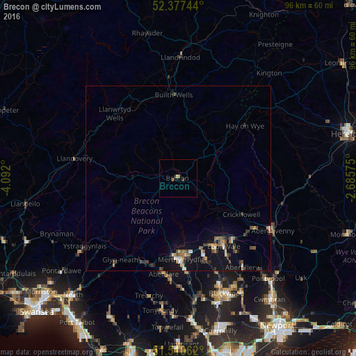
Analysis of Brecon night lights 2016
Square area 10x10 km:
 0%
0%90-99
0%80-89
0.51%70-79
0%60-69
1.01%50-59
0%40-49
0.38%30-39
0.13%20-29
0.51%10-19
0.51%0-9
96.97%Square area 50x50 km:
0.13%90-99
0.29%80-89
0.15%70-79
0.28%60-69
0.36%50-59
0.38%40-49
0.51%30-39
0.45%20-29
0.37%10-19
2.87%0-9
94.21%Clear (daylight) street map image can be seen on geolist.org.
Map coordinates:
52° 22' 38.8" North, 4° 5' 31.2" West
51° 56' 46" North, 3° 23' 19.9" West
51° 30' 38.2" North, 2° 41' 8.7" West
Some cities around Brecon sort by population:
• Merthyr Tydfil
22 km =13.7 mi,  178°
178°
• Ebbw Vale
22.5 km =14 mi,  146°
146°
• Brynmawr
21.5 km =13.4 mi,  139°
139°
• Tredegar
21.6 km =13.4 mi, 153°
• Rhymney
21.9 km =13.6 mi,  161°
161°
• Hirwaun
24.5 km =15.2 mi,  199°
199°
• Victoria
25.4 km =15.8 mi, 149°
• Abercanaid
24.8 km =15.4 mi, 176°
2654817 (p: 8,250)
Sources (retrieved 2019-11-25):
» Earth at Night: Flat Maps 2012, 2016