Braintree night lights from space
Night Light of Braintree (England) from space (United Kingdom) Src. Average luminocity for 10x10km area is 10.274% and for 50x50km: 5.5984%.
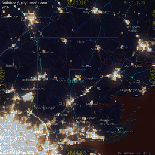
Analysis of Braintree night lights 2016
Square area 10x10 km:
 0.25%
0.25%90-99
1.26%80-89
1.64%70-79
1.52%60-69
1.52%50-59
1.77%40-49
2.02%30-39
1.14%20-29
0.76%10-19
1.01%0-9
87.12%Square area 50x50 km:
0.65%90-99
0.7%80-89
0.48%70-79
0.39%60-69
0.72%50-59
0.86%40-49
1.05%30-39
0.95%20-29
0.84%10-19
4.04%0-9
89.32%Clear (daylight) street map image can be seen on geolist.org.
Map coordinates:
52° 18' 36.6" North, 0° 9' 0.8" West
51° 52' 41.5" North, 0° 33' 10.5" East
51° 26' 31.3" North, 1° 15' 21.8" East
Some cities around Braintree sort by population:
• Chelmsford
16.8 km =10.4 mi,  199°
199°
• Witham
10.6 km =6.6 mi,  145°
145°
• Maldon
18.4 km =11.4 mi, 152°
• Halstead
9.5 km =5.9 mi,  38°
38°
• Tiptree
15.1 km =9.4 mi,  118°
118°
• Great Dunmow
13.1 km =8.1 mi,  267°
267°
• Danbury
18.1 km =11.2 mi,  173°
173°
• Kelvedon
11.3 km =7 mi,  111°
111°
2654938 (p: 53,477)
Sources (retrieved 2019-11-25):
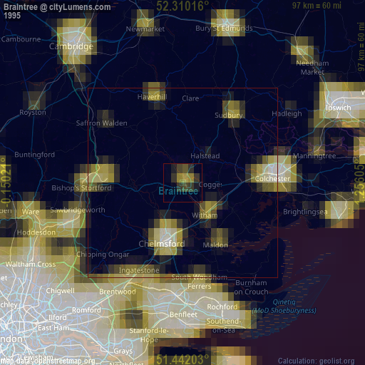
» NASA, Earths city lights 1995
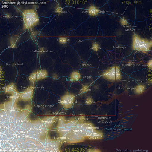
» NASA city lights 2003
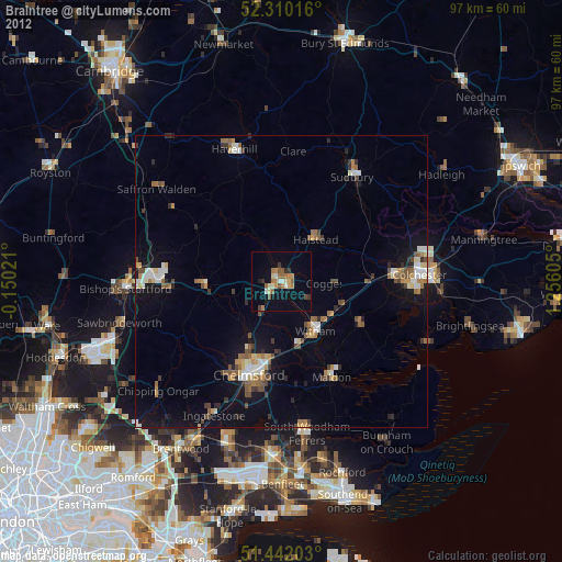
» Earth at Night: Flat Maps 2012, 2016