Brackley night lights from space
Night Light of Brackley (England) from space (United Kingdom) Src. Average luminocity for 10x10km area is 5.1338% and for 50x50km: 8.4765%.
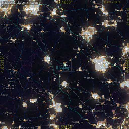
Analysis of Brackley night lights 2016
Square area 10x10 km:
 0.25%
0.25%90-99
0.25%80-89
0.51%70-79
0%60-69
1.01%50-59
2.4%40-49
2.65%30-39
0%20-29
0.25%10-19
0.25%0-9
92.42%Square area 50x50 km:
1.59%90-99
1.66%80-89
0.73%70-79
0.76%60-69
0.67%50-59
0.93%40-49
1.07%30-39
0.83%20-29
2%10-19
6.49%0-9
83.27%Clear (daylight) street map image can be seen on geolist.org.
Map coordinates:
52° 27' 49.7" North, 1° 51' 11.3" West
52° 1' 60" North, 1° 9' 0" West
51° 35' 55.2" North, 0° 26' 48.8" West
Some cities around Brackley sort by population:
• Milton Keynes
27 km =16.8 mi,  88°
88°
• Banbury
13.6 km =8.5 mi,  284°
284°
• Bicester
14.8 km =9.2 mi,  180°
180°
• Daventry
24.9 km =15.5 mi,  358°
358°
• Kidlington
25.4 km =15.8 mi,  201°
201°
• Buckingham
11.7 km =7.3 mi,  108°
108°
• Towcester
15.6 km =9.7 mi,  44°
44°
• Hardingstone
27 km =16.8 mi, 41°
2655012 (p: 13,018)
Sources (retrieved 2019-11-25):
» Earth at Night: Flat Maps 2012, 2016