Gorleston-on-Sea night lights from space
Night Light of Gorleston-on-Sea (England) from space (United Kingdom) Src. Average luminocity for 10x10km area is 24.1124% and for 50x50km: 2.4676%.
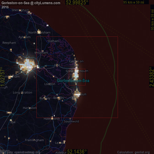
Analysis of Gorleston-on-Sea night lights 2016
Square area 10x10 km:
 5.69%
5.69%90-99
5.16%80-89
1.72%70-79
2.51%60-69
1.72%50-59
1.85%40-49
1.46%30-39
0.66%20-29
3.97%10-19
31.48%0-9
43.78%Square area 50x50 km:
0.34%90-99
0.35%80-89
0.13%70-79
0.23%60-69
0.23%50-59
0.41%40-49
0.45%30-39
0.34%20-29
0.42%10-19
2.65%0-9
94.46%Clear (daylight) street map image can be seen on geolist.org.
Map coordinates:
52° 59' 53.7" North, 1° 1' 39.3" East
52° 34' 22.8" North, 1° 43' 50.5" East
52° 8' 37" North, 2° 26' 1.8" East
Some cities around Gorleston-on-Sea sort by population:
• Lowestoft
11 km =6.8 mi,  172°
172°
• Great Yarmouth
3.9 km =2.4 mi,  359°
359°
• Beccles
16.9 km =10.5 mi,  221°
221°
• Bradwell
2.1 km =1.3 mi,  271°
271°
• Caister-on-Sea
8.4 km =5.2 mi, 358°
• Brundall
20.8 km =12.9 mi,  285°
285°
• Hemsby
14 km =8.7 mi,  349°
349°
• Bungay
23.8 km =14.8 mi,  236°
236°
2648299 (p: 5,882)
Sources (retrieved 2019-11-25):
» Earth at Night: Flat Maps 2012, 2016