Falkirk night lights from space
Night Light of Falkirk (Scotland) from space (United Kingdom) Src. Average luminocity for 10x10km area is 53.1667% and for 50x50km: 24.1407%.
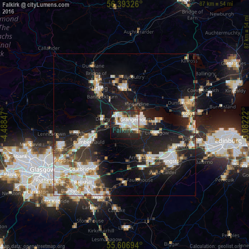
Analysis of Falkirk night lights 2016
Square area 10x10 km:
 14.79%
90-99
15.79%80-89
4.76%70-79
3.26%60-69
4.51%50-59
3.76%40-49
3.01%30-39
6.89%20-29
18.8%10-19
19.92%0-9
4.51%Square area 50x50 km:
5.23%90-99
5.52%80-89
1.77%70-79
2.57%60-69
2.52%50-59
2.42%40-49
2.55%30-39
3.02%20-29
7.38%10-19
16.41%0-9
50.61%Clear (daylight) street map image can be seen on geolist.org.
Map coordinates:
56° 23' 35.7" North, 4° 29' 18.5" West
56° 0' 7.6" North, 3° 47' 7.3" West
55° 36' 25" North, 3° 4' 56" West
Some cities around Falkirk sort by population:
• Grangemouth
4.1 km =2.5 mi,  75°
75°
• Bo’ness
10.6 km =6.6 mi, 81°
• Linlithgow
11.7 km =7.3 mi,  104°
104°
• Stenhousemuir
3.3 km =2.1 mi,  326°
326°
• Larbert
3.5 km =2.2 mi,  310°
310°
• Denny
8 km =5 mi,  287°
287°
• Polmont
5 km =3.1 mi, 104°
• Bonnybridge
6.4 km =4 mi,  269°
269°
2649723 (p: 35,310)
Sources (retrieved 2019-11-25):
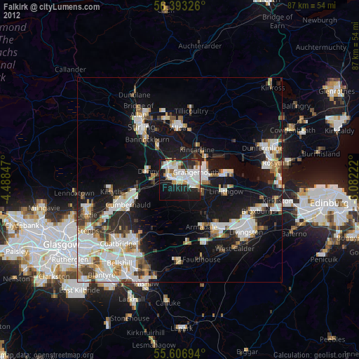
» Earth at Night: Flat Maps 2012, 2016