Vienne night lights from space
Night Light of Vienne (Auvergne-Rhône-Alpes) from space (France) Src. Average luminocity for 10x10km area is 36.2394% and for 50x50km: 24.4954%.
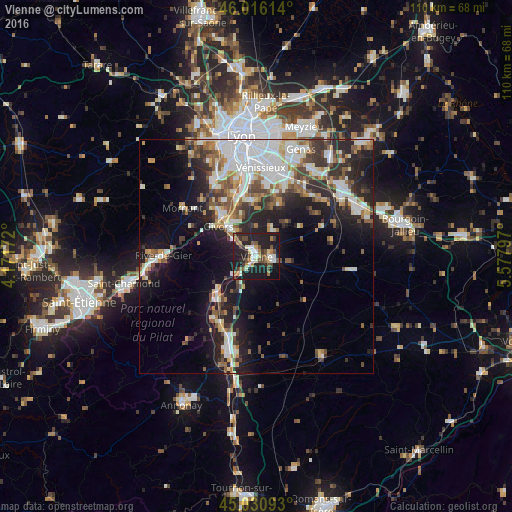
Analysis of Vienne night lights 2016
Square area 10x10 km:
 3.79%
3.79%90-99
6.21%80-89
3.18%70-79
2.88%60-69
4.85%50-59
6.21%40-49
7.58%30-39
4.55%20-29
18.48%10-19
38.18%0-9
4.09%Square area 50x50 km:
5.48%90-99
5.06%80-89
1.93%70-79
2.39%60-69
2.79%50-59
3.2%40-49
3.43%30-39
3.63%20-29
6.92%10-19
12.73%0-9
52.42%Clear (daylight) street map image can be seen on geolist.org.
Map coordinates:
46° 0' 58.1" North, 4° 10' 18.2" East
45° 31' 32.5" North, 4° 52' 29.4" East
45° 1' 51.3" North, 5° 34' 40.7" East
Some cities around Vienne sort by population:
• Givors
11 km =6.8 mi,  311°
311°
• Mions
16.4 km =10.2 mi,  21°
21°
• Corbas
16 km =9.9 mi,  7°
7°
• Feyzin
16.4 km =10.2 mi,  355°
355°
• Irigny
16.9 km =10.5 mi,  346°
346°
• Grigny
11.3 km =7 mi,  324°
324°
• Pont-Évêque
2.8 km =1.7 mi,  74°
74°
• Chasse-sur-Rhône
7.8 km =4.8 mi, 319°
2969284 (p: 32,293)
Sources (retrieved 2019-11-25):
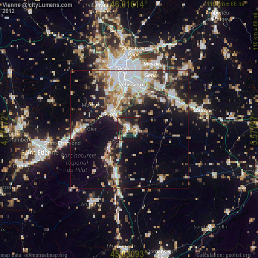
» Earth at Night: Flat Maps 2012, 2016