Saujon night lights from space
Night Light of Saujon (Nouvelle-Aquitaine) from space (France) Src. Average luminocity for 10x10km area is 11.1197% and for 50x50km: 5.609%.
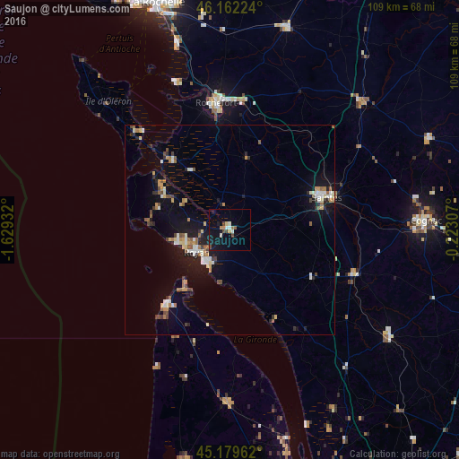
Analysis of Saujon night lights 2016
Square area 10x10 km:
 1.36%
1.36%90-99
1.67%80-89
0.61%70-79
1.82%60-69
0.45%50-59
0.76%40-49
2.42%30-39
0.61%20-29
0.45%10-19
12.73%0-9
77.12%Square area 50x50 km:
0.63%90-99
0.9%80-89
0.49%70-79
0.61%60-69
0.82%50-59
0.64%40-49
0.75%30-39
0.56%20-29
0.91%10-19
4.33%0-9
89.38%Clear (daylight) street map image can be seen on geolist.org.
Map coordinates:
46° 9' 44.1" North, 1° 37' 45.6" West
45° 40' 23.1" North, 0° 55' 34.3" West
45° 10' 46.6" North, 0° 13' 23.1" West
Some cities around Saujon sort by population:
• Saintes
24 km =14.9 mi,  70°
70°
• Rochefort
30.1 km =18.7 mi,  353°
353°
• Royan
9.3 km =5.8 mi,  237°
237°
• Tonnay-Charente
30.8 km =19.1 mi,  4°
4°
• Lesparre-Médoc
40.7 km =25.3 mi,  181°
181°
• Saint-Georges-de-Didonne
9.9 km =6.2 mi,  218°
218°
• Pons
31.2 km =19.4 mi,  109°
109°
• Marennes
21.7 km =13.5 mi,  320°
320°
2975844 (p: 5,803)
Sources (retrieved 2019-11-25):
» Earth at Night: Flat Maps 2012, 2016