Marennes night lights from space
Night Light of Marennes (Nouvelle-Aquitaine) from space (France) Src. Average luminocity for 10x10km area is 10.1577% and for 50x50km: 4.9911%.
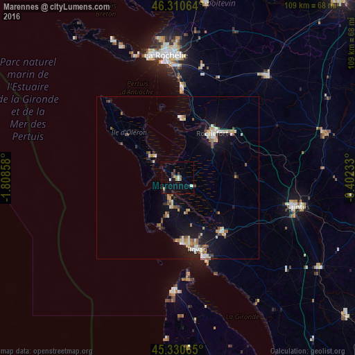
Analysis of Marennes night lights 2016
Square area 10x10 km:
 0.45%
0.45%90-99
2.23%80-89
0.45%70-79
1.04%60-69
1.34%50-59
0.89%40-49
1.93%30-39
1.49%20-29
2.38%10-19
1.93%0-9
85.86%Square area 50x50 km:
0.53%90-99
0.94%80-89
0.44%70-79
0.62%60-69
0.56%50-59
0.59%40-49
0.71%30-39
0.41%20-29
0.67%10-19
3.95%0-9
90.58%Clear (daylight) street map image can be seen on geolist.org.
Map coordinates:
46° 18' 38.3" North, 1° 48' 30.9" West
45° 49' 22.1" North, 1° 6' 19.7" West
45° 19' 50.3" North, 0° 24' 8.4" West
Some cities around Marennes sort by population:
• Rochefort
17.1 km =10.6 mi,  38°
38°
• Royan
22.4 km =13.9 mi,  164°
164°
• Aytré
34.8 km =21.6 mi,  358°
358°
• Tonnay-Charente
21.6 km =13.4 mi,  49°
49°
• Saint-Pierre-d’Oléron
20.6 km =12.8 mi,  310°
310°
• Châtelaillon-Plage
27.7 km =17.2 mi,  2°
2°
• Saujon
21.7 km =13.5 mi,  140°
140°
• Saint-Georges-de-Didonne
25.6 km =15.9 mi, 162°
2995854 (p: 5,027)
Sources (retrieved 2019-11-25):
» Earth at Night: Flat Maps 2012, 2016