Royan night lights from space
Night Light of Royan (Nouvelle-Aquitaine) from space (France) Src. Average luminocity for 10x10km area is 37.8121% and for 50x50km: 4.5503%.
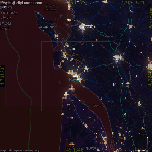
Analysis of Royan night lights 2016
Square area 10x10 km:
 6.67%
6.67%90-99
8.33%80-89
4.7%70-79
2.88%60-69
5.3%50-59
5%40-49
2.73%30-39
1.97%20-29
7.58%10-19
48.48%0-9
6.36%Square area 50x50 km:
0.43%90-99
0.65%80-89
0.4%70-79
0.57%60-69
0.72%50-59
0.47%40-49
0.71%30-39
0.44%20-29
0.73%10-19
3.54%0-9
91.34%Clear (daylight) street map image can be seen on geolist.org.
Map coordinates:
46° 7' 4.8" North, 1° 43' 52.4" West
45° 37' 42.5" North, 1° 1' 41.2" West
45° 8' 4.6" North, 0° 19' 29.9" West
Some cities around Royan sort by population:
• Saintes
33.2 km =20.6 mi,  66°
66°
• Rochefort
35.2 km =21.9 mi,  7°
7°
• Tonnay-Charente
37.1 km =23.1 mi,  16°
16°
• Saujon
9.3 km =5.8 mi,  57°
57°
• Lesparre-Médoc
36.4 km =22.6 mi,  168°
168°
• Saint-Georges-de-Didonne
3.3 km =2.1 mi,  147°
147°
• Pons
37.7 km =23.4 mi,  98°
98°
• Marennes
22.4 km =13.9 mi,  344°
344°
2982343 (p: 19,017)
Sources (retrieved 2019-11-25):
» Earth at Night: Flat Maps 2012, 2016