Lesparre-Médoc night lights from space
Night Light of Lesparre-Médoc (Nouvelle-Aquitaine) from space (France) Src. Average luminocity for 10x10km area is 6.0698% and for 50x50km: 2.8939%.
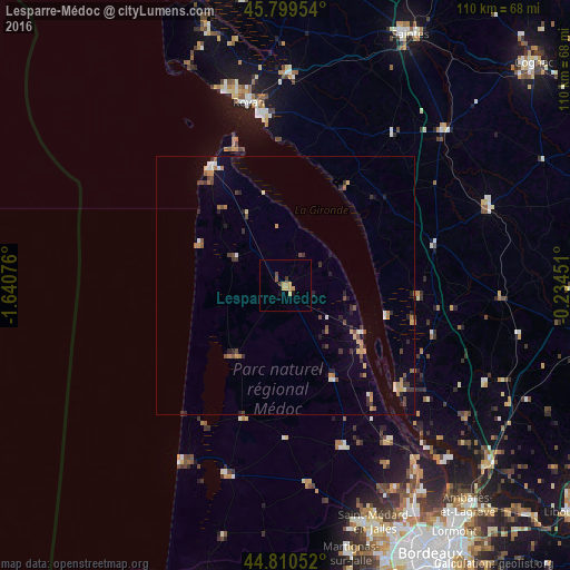
Analysis of Lesparre-Médoc night lights 2016
Square area 10x10 km:
 0%
0%90-99
0%80-89
0.32%70-79
3.17%60-69
1.59%50-59
0.63%40-49
0.63%30-39
1.27%20-29
0%10-19
0.95%0-9
91.43%Square area 50x50 km:
0.16%90-99
0.25%80-89
0.27%70-79
0.46%60-69
0.52%50-59
0.49%40-49
0.45%30-39
0.59%20-29
0.62%10-19
0.55%0-9
95.65%Clear (daylight) street map image can be seen on geolist.org.
Map coordinates:
45° 47' 58.3" North, 1° 38' 26.7" West
45° 18' 25.9" North, 0° 56' 15.5" West
44° 48' 37.9" North, 0° 14' 4.2" West
Some cities around Lesparre-Médoc sort by population:
• Royan
36.4 km =22.6 mi,  348°
348°
• Le Pian-Médoc
44.7 km =27.8 mi,  151°
151°
• Saujon
40.7 km =25.3 mi,  1°
1°
• Pauillac
19.2 km =11.9 mi,  129°
129°
• Saint-Aubin-de-Médoc
47 km =29.2 mi,  159°
159°
• Saint-Georges-de-Didonne
33.4 km =20.8 mi, 350°
• Blaye
29.4 km =18.3 mi, 132°
• Pons
42.9 km =26.7 mi,  45°
45°
3000072 (p: 5,406)
Sources (retrieved 2019-11-25):
» Earth at Night: Flat Maps 2012, 2016