Saint-Laurent-Blangy night lights from space
Night Light of Saint-Laurent-Blangy (Hauts-de-France) from space (France) Src. Average luminocity for 10x10km area is 54.2901% and for 50x50km: 27.1489%.
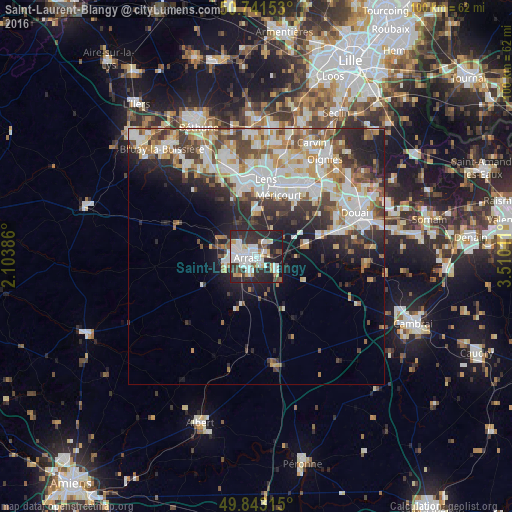
Analysis of Saint-Laurent-Blangy night lights 2016
Square area 10x10 km:
 17.51%
90-99
13.37%80-89
3.88%70-79
3.74%60-69
2.94%50-59
3.48%40-49
4.95%30-39
7.49%20-29
29.28%10-19
13.37%0-9
0%Square area 50x50 km:
6.11%90-99
7.05%80-89
2.51%70-79
2.97%60-69
3.22%50-59
2.75%40-49
3.37%30-39
4.08%20-29
6.84%10-19
8.09%0-9
53.02%Clear (daylight) street map image can be seen on geolist.org.
Map coordinates:
50° 44' 29.5" North, 2° 6' 13.9" East
50° 17' 40.1" North, 2° 48' 25.1" East
49° 50' 35.3" North, 3° 30' 36.4" East
Some cities around Saint-Laurent-Blangy sort by population:
• Arras
1.8 km =1.1 mi,  264°
264°
• Liévin
14.1 km =8.8 mi,  352°
352°
• Avion
13 km =8.1 mi,  7°
7°
• Méricourt
12.5 km =7.8 mi,  18°
18°
• Sallaumines
14.2 km =8.8 mi, 15°
• Rouvroy
12.9 km =8 mi,  32°
32°
• Achicourt
4.2 km =2.6 mi,  237°
237°
• Dainville
5.9 km =3.7 mi, 255°
2978949 (p: 5,713)
Sources (retrieved 2019-11-25):
» Earth at Night: Flat Maps 2012, 2016