Liévin night lights from space
Night Light of Liévin (Hauts-de-France) from space (France) Src. Average luminocity for 10x10km area is 76.2479% and for 50x50km: 39.0363%.
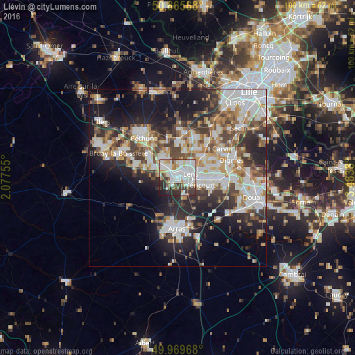
Analysis of Liévin night lights 2016
Square area 10x10 km:
 27.45%
90-99
28.71%80-89
4.2%70-79
5.18%60-69
3.78%50-59
5.04%40-49
3.5%30-39
12.46%20-29
7.28%10-19
2.38%0-9
0%Square area 50x50 km:
9.24%90-99
9.4%80-89
3.58%70-79
4%60-69
4.7%50-59
4.31%40-49
5.06%30-39
6.11%20-29
9.64%10-19
14.71%0-9
29.27%Clear (daylight) street map image can be seen on geolist.org.
Map coordinates:
50° 51' 56.4" North, 2° 4' 39.2" East
50° 25' 11.3" North, 2° 46' 50.4" East
49° 58' 10.8" North, 3° 29' 1.7" East
Some cities around Liévin sort by population:
• Lens
3.7 km =2.3 mi,  66°
66°
• Avion
3.7 km =2.3 mi,  106°
106°
• Bully-les-Mines
4.6 km =2.9 mi,  305°
305°
• Méricourt
6.2 km =3.9 mi, 109°
• Sallaumines
5.7 km =3.5 mi,  92°
92°
• Loos-en-Gohelle
4.3 km =2.7 mi,  10°
10°
• Grenay
3.9 km =2.4 mi,  328°
328°
• Loison-sous-Lens
5.5 km =3.4 mi, 68°
2998431 (p: 34,370)
Sources (retrieved 2019-11-25):
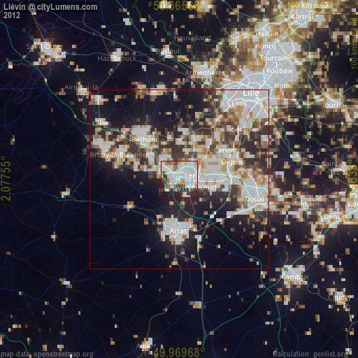
» Earth at Night: Flat Maps 2012, 2016