Beauvais night lights from space
Night Light of Beauvais (Hauts-de-France) from space (France) Src. Average luminocity for 10x10km area is 47.5084% and for 50x50km: 8.0691%.
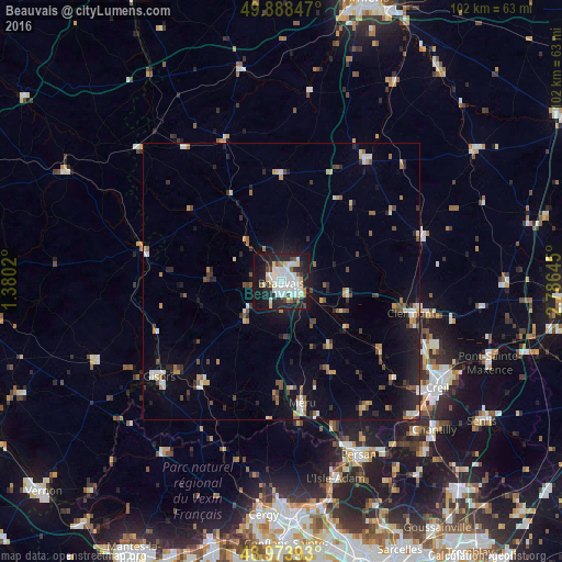

Analysis of Beauvais night lights 2016
Square area 10x10 km:
 14.15%
90-99
14.57%80-89
3.22%70-79
2.24%60-69
3.08%50-59
1.96%40-49
3.64%30-39
3.5%20-29
18.35%10-19
29.41%0-9
5.88%Square area 50x50 km:
1.08%90-99
1.27%80-89
0.61%70-79
0.77%60-69
1%50-59
0.89%40-49
1.13%30-39
0.93%20-29
2.21%10-19
5.88%0-9
84.22%Clear (daylight) street map image can be seen on geolist.org.
Map coordinates:
49° 53' 18.5" North, 1° 22' 48.7" East
49° 25' 60" North, 2° 4' 60" East
48° 58' 26.1" North, 2° 47' 11.2" East
Some cities around Beauvais sort by population:
• Méru
22.5 km =14 mi,  170°
170°
• Gisors
27.7 km =17.2 mi,  232°
232°
• Clermont
24.6 km =15.3 mi,  104°
104°
• Chambly
32 km =19.9 mi,  157°
157°
• Liancourt
30 km =18.6 mi,  112°
112°
• Gournay-en-Bray
26.5 km =16.5 mi,  281°
281°
• Saint-Just-en-Chaussée
26.5 km =16.5 mi,  72°
72°
• Mouy
21.6 km =13.4 mi,  127°
127°
3034006 (p: 53,393)
Sources (retrieved 2019-11-25):
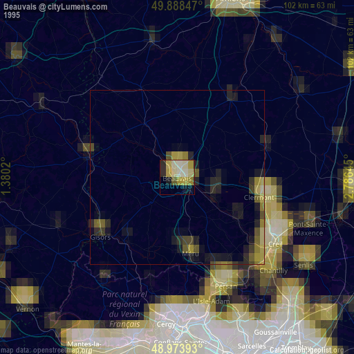
» NASA, Earths city lights 1995
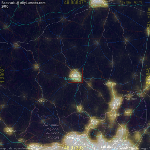
» NASA city lights 2003
» Earth at Night: Flat Maps 2012, 2016