Saint-Égrève night lights from space
Night Light of Saint-Égrève (Auvergne-Rhône-Alpes) from space (France) Src. Average luminocity for 10x10km area is 49.0636% and for 50x50km: 12.0924%.
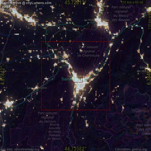
Analysis of Saint-Égrève night lights 2016
Square area 10x10 km:
 15.3%
15.3%90-99
12.88%80-89
2.42%70-79
2.27%60-69
2.88%50-59
3.33%40-49
3.18%30-39
12.12%20-29
20.61%10-19
20.61%0-9
4.39%Square area 50x50 km:
2.14%90-99
2.06%80-89
0.98%70-79
1.12%60-69
1.13%50-59
1.76%40-49
1.44%30-39
2.39%20-29
3.63%10-19
8.62%0-9
74.73%Clear (daylight) street map image can be seen on geolist.org.
Map coordinates:
45° 43' 34.1" North, 4° 58' 42.3" East
45° 13' 59.3" North, 5° 40' 53.5" East
44° 44' 9" North, 6° 23' 4.8" East
Some cities around Saint-Égrève sort by population:
• Grenoble
6.6 km =4.1 mi,  156°
156°
• Fontaine
4.5 km =2.8 mi,  173°
173°
• Meylan
8 km =5 mi,  109°
109°
• Seyssinet-Pariset
6.3 km =3.9 mi, 171°
• Sassenage
2.7 km =1.7 mi,  212°
212°
• Voreppe
7.9 km =4.9 mi,  330°
330°
• Seyssins
7.9 km =4.9 mi,  177°
177°
• La Tronche
6 km =3.7 mi,  121°
121°
2980636 (p: 15,904)
Sources (retrieved 2019-11-25):
» Earth at Night: Flat Maps 2012, 2016