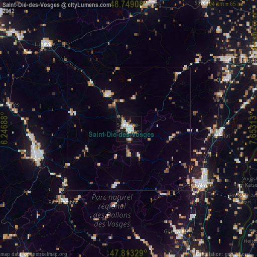
Saint-Dié-des-Vosges night lights from space
Night Light of Saint-Dié-des-Vosges (Grand Est) from space (France) Src. Average luminocity for 10x10km area is 22.5551% and for 50x50km: 3.6242%.
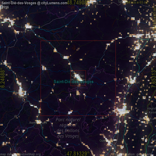
Analysis of Saint-Dié-des-Vosges night lights 2016
Square area 10x10 km:
 4.91%
4.91%90-99
6.25%80-89
1.34%70-79
0.6%60-69
1.49%50-59
2.08%40-49
1.93%30-39
1.64%20-29
1.19%10-19
29.76%0-9
48.81%Square area 50x50 km:
0.5%90-99
0.63%80-89
0.26%70-79
0.49%60-69
0.36%50-59
0.36%40-49
0.45%30-39
0.47%20-29
0.6%10-19
1.89%0-9
93.98%Clear (daylight) street map image can be seen on geolist.org.
Map coordinates:
48° 44' 56.7" North, 6° 14' 48.8" East
48° 16' 60" North, 6° 57' 0" East
47° 48' 47.8" North, 7° 39' 11.3" East
Some cities around Saint-Dié-des-Vosges sort by population:
• Colmar
37.6 km =23.4 mi,  126°
126°
• Épinal
38.5 km =23.9 mi,  253°
253°
• Sélestat
37 km =23 mi,  93°
93°
• Gérardmer
23.9 km =14.9 mi,  192°
192°
• Wintzenheim
34.4 km =21.4 mi, 132°
• Rambervillers
24.1 km =15 mi,  285°
285°
• Munster
30.4 km =18.9 mi,  152°
152°
• La Bresse
32.2 km =20 mi, 191°
2980827 (p: 24,628)
Sources (retrieved 2019-11-25):
» Earth at Night: Flat Maps 2012, 2016