Saint-Avertin night lights from space
Night Light of Saint-Avertin (Centre) from space (France) Src. Average luminocity for 10x10km area is 58.6652% and for 50x50km: 7.3192%.
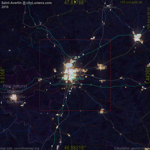
Analysis of Saint-Avertin night lights 2016
Square area 10x10 km:
 15.03%
90-99
20.54%80-89
6.1%70-79
4.32%60-69
3.87%50-59
5.21%40-49
7.14%30-39
4.61%20-29
11.01%10-19
15.92%0-9
6.25%Square area 50x50 km:
1.14%90-99
1.69%80-89
0.73%70-79
0.74%60-69
0.64%50-59
0.74%40-49
1.16%30-39
0.95%20-29
2.12%10-19
3.99%0-9
86.1%Clear (daylight) street map image can be seen on geolist.org.
Map coordinates:
47° 50' 15.6" North, 0° 2' 12.5" East
47° 21' 48.9" North, 0° 44' 23.7" East
46° 53' 6.6" North, 1° 26' 35" East
Some cities around Saint-Avertin sort by population:
• Tours
4.4 km =2.7 mi,  322°
322°
• Joué-lès-Tours
5.5 km =3.4 mi,  256°
256°
• Chambray-lès-Tours
4.2 km =2.6 mi,  221°
221°
• Montlouis-sur-Loire
7.5 km =4.7 mi,  68°
68°
• Fondettes
11.7 km =7.3 mi,  292°
292°
• La Riche
6 km =3.7 mi,  299°
299°
• Ballan-Miré
9.8 km =6.1 mi,  254°
254°
• Veigné
8.7 km =5.4 mi,  179°
179°
2981512 (p: 16,007)
Sources (retrieved 2019-11-25):
» Earth at Night: Flat Maps 2012, 2016