Tours night lights from space
Night Light of Tours (Centre) from space (France) Src. Average luminocity for 10x10km area is 75.1733% and for 50x50km: 7.4605%.
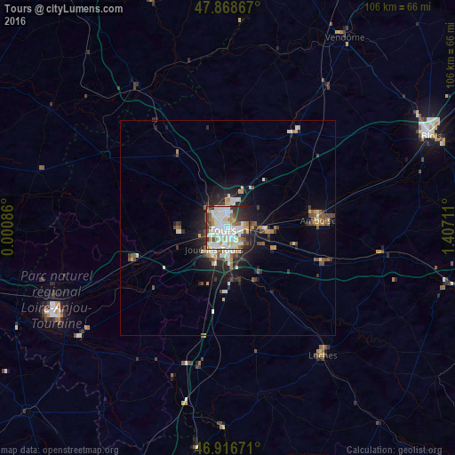
Analysis of Tours night lights 2016
Square area 10x10 km:
 23.01%
90-99
29.83%80-89
6.11%70-79
5.11%60-69
5.82%50-59
4.26%40-49
7.1%30-39
7.81%20-29
8.81%10-19
2.13%0-9
0%Square area 50x50 km:
1.17%90-99
1.75%80-89
0.78%70-79
0.73%60-69
0.63%50-59
0.72%40-49
1.17%30-39
0.99%20-29
2.18%10-19
4.05%0-9
85.82%Clear (daylight) street map image can be seen on geolist.org.
Map coordinates:
47° 52' 7.2" North, 0° 0' 3.1" East
47° 23' 41.4" North, 0° 42' 14.3" East
46° 55' 0.2" North, 1° 24' 25.6" East
Some cities around Tours sort by population:
• Joué-lès-Tours
5.4 km =3.4 mi,  209°
209°
• Saint-Cyr-sur-Loire
2.9 km =1.8 mi,  281°
281°
• Saint-Avertin
4.4 km =2.7 mi,  142°
142°
• Saint-Pierre-des-Corps
3.5 km =2.2 mi,  105°
105°
• Chambray-lès-Tours
6.6 km =4.1 mi,  180°
180°
• Fondettes
8.1 km =5 mi, 276°
• La Riche
2.6 km =1.6 mi,  257°
257°
• Ballan-Miré
9 km =5.6 mi,  228°
228°
2972191 (p: 141,621)
Sources (retrieved 2019-11-25):
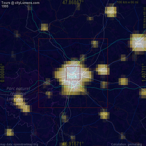
» NASA, Earths city lights 1995
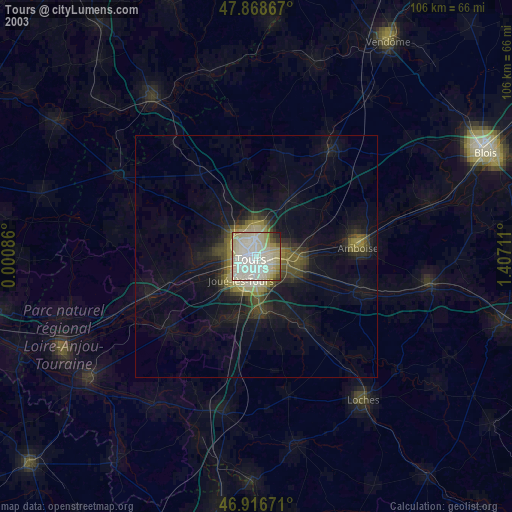
» NASA city lights 2003
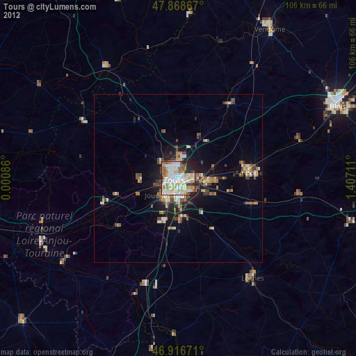
» Earth at Night: Flat Maps 2012, 2016