Montlouis-sur-Loire night lights from space
Night Light of Montlouis-sur-Loire (Centre) from space (France) Src. Average luminocity for 10x10km area is 15.0369% and for 50x50km: 7.362%.
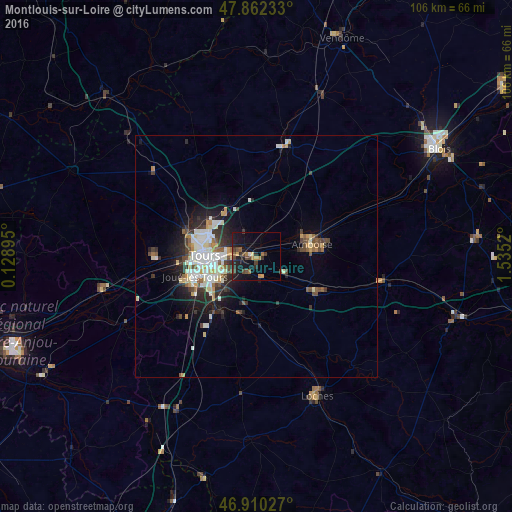
Analysis of Montlouis-sur-Loire night lights 2016
Square area 10x10 km:
 0.28%
0.28%90-99
0.28%80-89
1.14%70-79
2.84%60-69
2.56%50-59
1.7%40-49
4.97%30-39
2.41%20-29
4.55%10-19
19.18%0-9
60.09%Square area 50x50 km:
1.17%90-99
1.74%80-89
0.75%70-79
0.75%60-69
0.62%50-59
0.67%40-49
1.13%30-39
0.95%20-29
2.14%10-19
4.05%0-9
86.02%Clear (daylight) street map image can be seen on geolist.org.
Map coordinates:
47° 51' 44.4" North, 0° 7' 44.2" East
47° 23' 18.4" North, 0° 49' 55.5" East
46° 54' 37" North, 1° 32' 6.7" East
Some cities around Montlouis-sur-Loire sort by population:
• Tours
9.7 km =6 mi,  274°
274°
• Joué-lès-Tours
12.9 km =8 mi,  251°
251°
• Saint-Cyr-sur-Loire
12.5 km =7.8 mi,  275°
275°
• Saint-Avertin
7.5 km =4.7 mi, 248°
• Saint-Pierre-des-Corps
6.3 km =3.9 mi, 267°
• Amboise
11.6 km =7.2 mi,  76°
76°
• Chambray-lès-Tours
11.4 km =7.1 mi,  238°
238°
• La Riche
12.1 km =7.5 mi, 270°
2992293 (p: 10,137)
Sources (retrieved 2019-11-25):
» Earth at Night: Flat Maps 2012, 2016