Chambray-lès-Tours night lights from space
Night Light of Chambray-lès-Tours (Centre) from space (France) Src. Average luminocity for 10x10km area is 52.7396% and for 50x50km: 7.5712%.
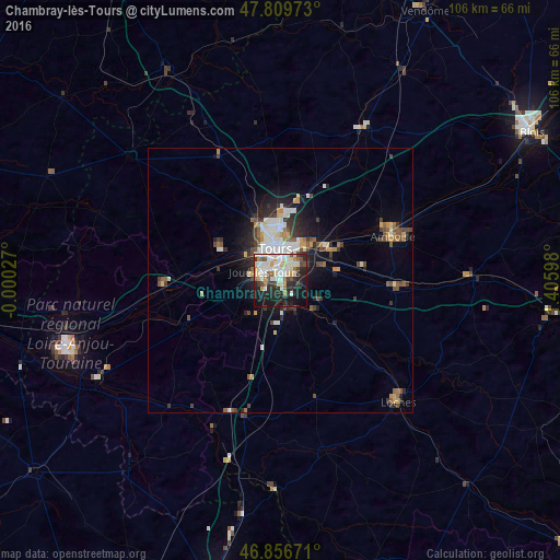
Analysis of Chambray-lès-Tours night lights 2016
Square area 10x10 km:
 10.57%
90-99
17.56%80-89
6.99%70-79
4.91%60-69
3.57%50-59
3.13%40-49
4.91%30-39
4.76%20-29
18.75%10-19
21.43%0-9
3.42%Square area 50x50 km:
1.14%90-99
1.71%80-89
0.78%70-79
0.77%60-69
0.68%50-59
0.82%40-49
1.28%30-39
1.05%20-29
2.19%10-19
3.97%0-9
85.61%Clear (daylight) street map image can be seen on geolist.org.
Map coordinates:
47° 48' 35" North, 0° 0' 1" West
47° 20' 7.3" North, 0° 42' 10.3" East
46° 51' 24.2" North, 1° 24' 21.5" East
Some cities around Chambray-lès-Tours sort by population:
• Tours
6.6 km =4.1 mi,  0°
0°
• Joué-lès-Tours
3.2 km =2 mi,  306°
306°
• Saint-Cyr-sur-Loire
7.7 km =4.8 mi,  339°
339°
• Saint-Avertin
4.2 km =2.6 mi,  41°
41°
• Saint-Pierre-des-Corps
6.6 km =4.1 mi,  31°
31°
• La Riche
6.5 km =4 mi, 338°
• Ballan-Miré
6.7 km =4.2 mi,  274°
274°
• Veigné
6.2 km =3.9 mi,  152°
152°
3027343 (p: 10,910)
Sources (retrieved 2019-11-25):
» Earth at Night: Flat Maps 2012, 2016