Riorges night lights from space
Night Light of Riorges (Auvergne-Rhône-Alpes) from space (France) Src. Average luminocity for 10x10km area is 41.6321% and for 50x50km: 3.6238%.
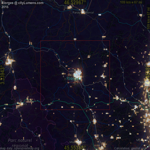
Analysis of Riorges night lights 2016
Square area 10x10 km:
 12.78%
90-99
10.8%80-89
0.57%70-79
2.41%60-69
3.69%50-59
4.55%40-49
3.27%30-39
6.82%20-29
11.36%10-19
24.86%0-9
18.89%Square area 50x50 km:
0.61%90-99
0.68%80-89
0.15%70-79
0.21%60-69
0.34%50-59
0.51%40-49
0.66%30-39
0.59%20-29
0.91%10-19
2.45%0-9
92.9%Clear (daylight) street map image can be seen on geolist.org.
Map coordinates:
46° 31' 46.8" North, 3° 20' 21.9" East
46° 2' 37.6" North, 4° 2' 33.2" East
45° 33' 12.9" North, 4° 44' 44.4" East
Some cities around Riorges sort by population:
• Roanne
2.1 km =1.3 mi,  113°
113°
• Thiers
43.6 km =27.1 mi,  241°
241°
• Saint-François
42.6 km =26.5 mi,  345°
345°
• Tarare
34.4 km =21.4 mi,  118°
118°
• Feurs
37.4 km =23.2 mi,  157°
157°
• Mably
2.7 km =1.7 mi,  30°
30°
• Le Coteau
4.7 km =2.9 mi,  125°
125°
• Amplepuis
23.6 km =14.7 mi, 109°
2983482 (p: 10,763)
Sources (retrieved 2019-11-25):
» Earth at Night: Flat Maps 2012, 2016