Saint-François night lights from space
Night Light of Saint-François (Auvergne-Rhône-Alpes) from space (France) Src. Average luminocity for 10x10km area is 0.0625% and for 50x50km: 1.1921%.
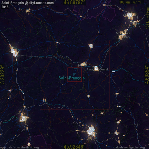
Analysis of Saint-François night lights 2016
Square area 10x10 km:
 0%
0%90-99
0%80-89
0%70-79
0%60-69
0%50-59
0%40-49
0%30-39
0%20-29
0%10-19
0%0-9
100%Square area 50x50 km:
0.18%90-99
0.22%80-89
0.09%70-79
0.06%60-69
0.22%50-59
0.16%40-49
0.18%30-39
0.16%20-29
0.14%10-19
0.11%0-9
98.47%Clear (daylight) street map image can be seen on geolist.org.
Map coordinates:
46° 53' 52.7" North, 3° 12' 8.2" East
46° 24' 55.3" North, 3° 54' 19.5" East
45° 55' 42.5" North, 4° 36' 30.7" East
Some cities around Saint-François sort by population:
• Roanne
44 km =27.3 mi,  163°
163°
• Montceau-les-Mines
45 km =28 mi,  51°
51°
• Riorges
42.6 km =26.5 mi,  165°
165°
• Paray-le-Monial
16.7 km =10.4 mi,  74°
74°
• Digoin
9.3 km =5.8 mi,  37°
37°
• Gueugnon
24.1 km =15 mi,  29°
29°
• Mably
40.8 km =25.4 mi, 163°
• Bourbon-Lancy
25.2 km =15.7 mi,  335°
335°
2980080 (p: 13,577)
Sources (retrieved 2019-11-25):
» Earth at Night: Flat Maps 2012, 2016