Pont-Saint-Martin night lights from space
Night Light of Pont-Saint-Martin (Pays de la Loire) from space (France) Src. Average luminocity for 10x10km area is 31.6733% and for 50x50km: 15.4056%.
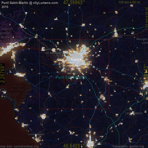
Analysis of Pont-Saint-Martin night lights 2016
Square area 10x10 km:
 4.55%
4.55%90-99
3.69%80-89
1.7%70-79
4.55%60-69
3.13%50-59
4.97%40-49
5.11%30-39
7.67%20-29
17.47%10-19
23.86%0-9
23.3%Square area 50x50 km:
3.86%90-99
2.94%80-89
1.16%70-79
1.53%60-69
1.98%50-59
1.92%40-49
1.85%30-39
1.78%20-29
3.67%10-19
6.71%0-9
72.61%Clear (daylight) street map image can be seen on geolist.org.
Map coordinates:
47° 35' 58.7" North, 2° 17' 15.6" West
47° 7' 24.2" North, 1° 35' 4.4" West
46° 38' 34.1" North, 0° 52' 53.1" West
Some cities around Pont-Saint-Martin sort by population:
• Rezé
7 km =4.3 mi,  22°
22°
• Vertou
10.1 km =6.3 mi,  59°
59°
• Bouguenais
6.6 km =4.1 mi,  335°
335°
• Saint-Philbert-de-Grand-Lieu
10.6 km =6.6 mi,  203°
203°
• Les Sorinières
5 km =3.1 mi, 56°
• La Montagne
10.2 km =6.3 mi,  313°
313°
• Bouaye
8.5 km =5.3 mi,  284°
284°
• La Chevrolière
4 km =2.5 mi,  208°
208°
2986106 (p: 5,114)
Sources (retrieved 2019-11-25):
» Earth at Night: Flat Maps 2012, 2016