Plouay night lights from space
Night Light of Plouay (Brittany) from space (France) Src. Average luminocity for 10x10km area is 2.6761% and for 50x50km: 5.027%.
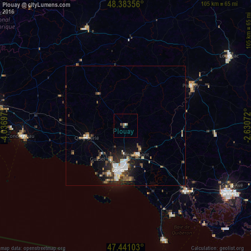
Analysis of Plouay night lights 2016
Square area 10x10 km:
 0.43%
0.43%90-99
0.14%80-89
0%70-79
0%60-69
0.57%50-59
1.7%40-49
0%30-39
0.57%20-29
0%10-19
1.14%0-9
95.45%Square area 50x50 km:
0.77%90-99
0.91%80-89
0.39%70-79
0.34%60-69
0.61%50-59
0.85%40-49
0.8%30-39
0.75%20-29
1.59%10-19
3.18%0-9
89.8%Clear (daylight) street map image can be seen on geolist.org.
Map coordinates:
48° 23' 0.8" North, 4° 2' 13.1" West
47° 54' 52" North, 3° 20' 1.8" West
47° 26' 27.7" North, 2° 37' 50.6" West
Some cities around Plouay sort by population:
• Lorient
18.9 km =11.7 mi,  187°
187°
• Lanester
17 km =10.6 mi,  181°
181°
• Ploemeur
21.5 km =13.4 mi,  200°
200°
• Hennebont
13 km =8.1 mi,  159°
159°
• Quimperlé
17 km =10.6 mi,  251°
251°
• Quéven
15.8 km =9.8 mi, 202°
• Caudan
11.8 km =7.3 mi, 183°
• Languidic
15.9 km =9.9 mi,  124°
124°
2986696 (p: 5,166)
Sources (retrieved 2019-11-25):
» Earth at Night: Flat Maps 2012, 2016