Ostricourt night lights from space
Night Light of Ostricourt (Hauts-de-France) from space (France) Src. Average luminocity for 10x10km area is 72.6849% and for 50x50km: 46.5229%.
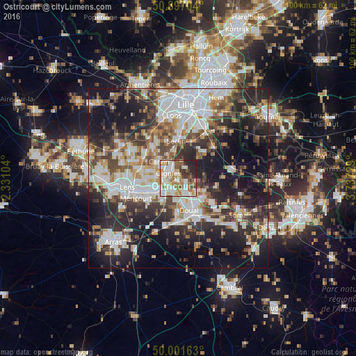
Analysis of Ostricourt night lights 2016
Square area 10x10 km:
 19.89%
90-99
20.31%80-89
6.02%70-79
10.5%60-69
14.71%50-59
7.14%40-49
4.76%30-39
6.44%20-29
8.4%10-19
1.82%0-9
0%Square area 50x50 km:
11.03%90-99
10.15%80-89
3.92%70-79
4.81%60-69
5.6%50-59
5.44%40-49
6.66%30-39
7.5%20-29
13.61%10-19
19.55%0-9
11.73%Clear (daylight) street map image can be seen on geolist.org.
Map coordinates:
50° 53' 49.3" North, 2° 19' 51.7" East
50° 27' 5.2" North, 3° 2' 3" East
50° 0' 5.9" North, 3° 44' 14.2" East
Some cities around Ostricourt sort by population:
• Oignies
3.1 km =1.9 mi,  294°
294°
• Libercourt
3.8 km =2.4 mi,  339°
339°
• Auby
4.3 km =2.7 mi,  161°
161°
• Leforest
2.6 km =1.6 mi,  123°
123°
• Courcelles-lès-Lens
4.1 km =2.5 mi,  197°
197°
• Roost-Warendin
6.1 km =3.8 mi,  126°
126°
• Dourges
3.8 km =2.4 mi,  243°
243°
• Noyelles-Godault
4.8 km =3 mi,  217°
217°
2989094 (p: 5,522)
Sources (retrieved 2019-11-25):
» Earth at Night: Flat Maps 2012, 2016