Auby night lights from space
Night Light of Auby (Hauts-de-France) from space (France) Src. Average luminocity for 10x10km area is 76.2983% and for 50x50km: 43.1239%.
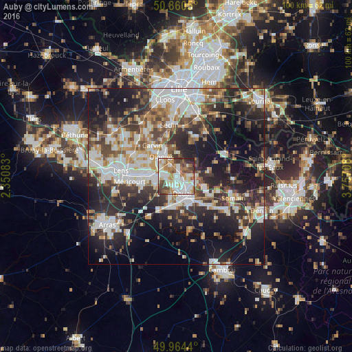
Analysis of Auby night lights 2016
Square area 10x10 km:
 22.97%
90-99
22.69%80-89
6.16%70-79
7.14%60-69
14.85%50-59
7.28%40-49
10.22%30-39
5.04%20-29
3.5%10-19
0.14%0-9
0%Square area 50x50 km:
9.4%90-99
9.64%80-89
3.7%70-79
4.33%60-69
5.4%50-59
5.02%40-49
6.18%30-39
7.11%20-29
12.93%10-19
19.55%0-9
16.73%Clear (daylight) street map image can be seen on geolist.org.
Map coordinates:
50° 51' 37.8" North, 2° 21' 3" East
50° 24' 52.5" North, 3° 3' 14.3" East
49° 57' 51.8" North, 3° 45' 25.5" East
Some cities around Auby sort by population:
• Douai
5.2 km =3.2 mi,  159°
159°
• Cuincy
3.9 km =2.4 mi,  180°
180°
• Leforest
2.8 km =1.7 mi,  15°
15°
• Courcelles-lès-Lens
2.7 km =1.7 mi,  275°
275°
• Roost-Warendin
3.6 km =2.2 mi,  81°
81°
• Flers-en-Escrebieux
1.9 km =1.2 mi,  166°
166°
• Noyelles-Godault
4.3 km =2.7 mi,  274°
274°
• Ostricourt
4.3 km =2.7 mi,  341°
341°
3036289 (p: 7,836)
Sources (retrieved 2019-11-25):
» Earth at Night: Flat Maps 2012, 2016