Niort night lights from space
Night Light of Niort (Nouvelle-Aquitaine) from space (France) Src. Average luminocity for 10x10km area is 39.9122% and for 50x50km: 2.9907%.
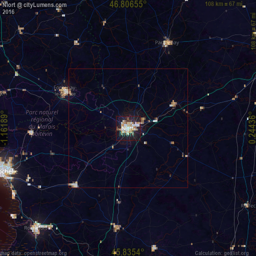
Analysis of Niort night lights 2016
Square area 10x10 km:
 3.72%
3.72%90-99
12.2%80-89
6.85%70-79
4.61%60-69
4.46%50-59
2.38%40-49
3.42%30-39
3.57%20-29
8.33%10-19
40.48%0-9
9.97%Square area 50x50 km:
0.26%90-99
0.66%80-89
0.35%70-79
0.46%60-69
0.27%50-59
0.34%40-49
0.27%30-39
0.32%20-29
0.53%10-19
2.42%0-9
94.11%Clear (daylight) street map image can be seen on geolist.org.
Map coordinates:
46° 48' 23.6" North, 1° 9' 42.8" West
46° 19' 23.3" North, 0° 27' 31.6" West
45° 50' 7.4" North, 0° 14' 39.7" East
Some cities around Niort sort by population:
• Fontenay-le-Comte
31.1 km =19.3 mi,  300°
300°
• Parthenay
39.6 km =24.6 mi,  24°
24°
• Aytré
54.6 km =33.9 mi,  247°
247°
• Tonnay-Charente
53.4 km =33.2 mi,  218°
218°
• Lagord
55.5 km =34.5 mi, 254°
• Périgny
52.6 km =32.7 mi, 249°
• Surgères
32.8 km =20.4 mi, 223°
• Dompierre-sur-Mer
48.9 km =30.4 mi, 252°
2990355 (p: 54,660)
Sources (retrieved 2019-11-25):
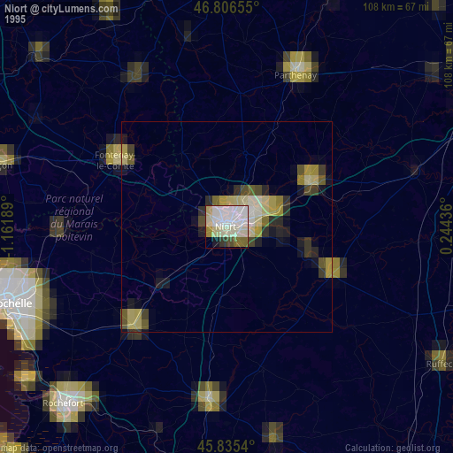
» NASA, Earths city lights 1995
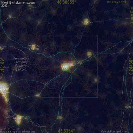
» NASA city lights 2003
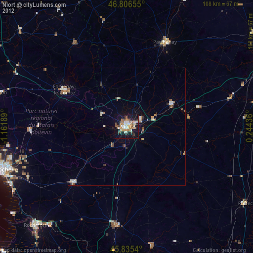
» Earth at Night: Flat Maps 2012, 2016