Fontenay-le-Comte night lights from space
Night Light of Fontenay-le-Comte (Pays de la Loire) from space (France) Src. Average luminocity for 10x10km area is 14.9347% and for 50x50km: 1.8825%.
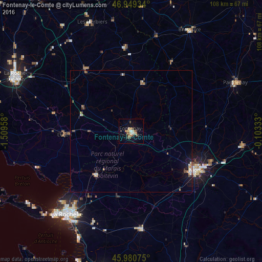
Analysis of Fontenay-le-Comte night lights 2016
Square area 10x10 km:
 0.85%
0.85%90-99
1.7%80-89
2.7%70-79
1.56%60-69
2.56%50-59
3.27%40-49
2.13%30-39
2.41%20-29
0.43%10-19
4.97%0-9
77.41%Square area 50x50 km:
0.11%90-99
0.3%80-89
0.23%70-79
0.27%60-69
0.2%50-59
0.39%40-49
0.3%30-39
0.22%20-29
0.18%10-19
1.02%0-9
96.79%Clear (daylight) street map image can be seen on geolist.org.
Map coordinates:
46° 56' 57.6" North, 1° 30' 34.5" West
46° 28' 1.9" North, 0° 48' 23.2" West
45° 58' 50.7" North, 0° 6' 12" West
Some cities around Fontenay-le-Comte sort by population:
• Niort
31.1 km =19.3 mi,  120°
120°
• Luçon
27.5 km =17.1 mi,  267°
267°
• Chantonnay
30.7 km =19.1 mi,  322°
322°
• Lagord
40.9 km =25.4 mi,  220°
220°
• Nieul-sur-Mer
40 km =24.9 mi, 223°
• Pouzauges
34.8 km =21.6 mi,  356°
356°
• Surgères
40.1 km =24.9 mi,  173°
173°
• Dompierre-sur-Mer
36.8 km =22.9 mi,  212°
212°
3017921 (p: 16,316)
Sources (retrieved 2019-11-25):
» Earth at Night: Flat Maps 2012, 2016