Lagord night lights from space
Night Light of Lagord (Nouvelle-Aquitaine) from space (France) Src. Average luminocity for 10x10km area is 58.2727% and for 50x50km: 5.4977%.
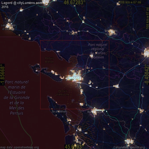
Analysis of Lagord night lights 2016
Square area 10x10 km:
 15.06%
90-99
18.32%80-89
6.96%70-79
6.39%60-69
4.4%50-59
2.98%40-49
4.4%30-39
6.25%20-29
13.78%10-19
18.47%0-9
2.98%Square area 50x50 km:
0.94%90-99
1.22%80-89
0.45%70-79
0.58%60-69
0.43%50-59
0.52%40-49
0.45%30-39
0.6%20-29
1.48%10-19
3.94%0-9
89.39%Clear (daylight) street map image can be seen on geolist.org.
Map coordinates:
46° 40' 22.2" North, 1° 51' 24" West
46° 11' 17.6" North, 1° 9' 12.8" West
45° 41' 57.5" North, 0° 27' 1.5" West
Some cities around Lagord sort by population:
• La Rochelle
2.4 km =1.5 mi,  173°
173°
• Luçon
30 km =18.6 mi,  358°
358°
• Aytré
6.6 km =4.1 mi,  152°
152°
• Saint-Pierre-d’Oléron
29.6 km =18.4 mi,  203°
203°
• Périgny
5.6 km =3.5 mi,  130°
130°
• Châtelaillon-Plage
13.8 km =8.6 mi,  159°
159°
• Nieul-sur-Mer
2.1 km =1.3 mi,  336°
336°
• Dompierre-sur-Mer
6.9 km =4.3 mi,  90°
90°
3009052 (p: 6,987)
Sources (retrieved 2019-11-25):
» Earth at Night: Flat Maps 2012, 2016