Neufchâtel-en-Bray night lights from space
Night Light of Neufchâtel-en-Bray (Normandy) from space (France) Src. Average luminocity for 10x10km area is 2.8904% and for 50x50km: 1.9418%.
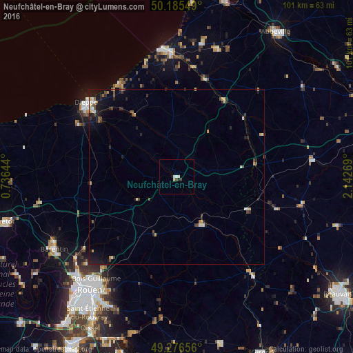
Analysis of Neufchâtel-en-Bray night lights 2016
Square area 10x10 km:
 0.27%
0.27%90-99
0.8%80-89
1.07%70-79
0%60-69
0%50-59
0%40-49
0.53%30-39
0.53%20-29
0%10-19
1.07%0-9
95.72%Square area 50x50 km:
0.15%90-99
0.31%80-89
0.2%70-79
0.23%60-69
0.15%50-59
0.23%40-49
0.41%30-39
0.29%20-29
0.53%10-19
1.55%0-9
95.93%Clear (daylight) street map image can be seen on geolist.org.
Map coordinates:
50° 11' 7.8" North, 0° 44' 11.2" East
49° 43' 59.3" North, 1° 26' 22.4" East
49° 16' 35.6" North, 2° 8' 33.7" East
Some cities around Neufchâtel-en-Bray sort by population:
• Dieppe
33.4 km =20.8 mi,  308°
308°
• Bois-Guillaume
38 km =23.6 mi,  217°
217°
• Darnétal
38.2 km =23.7 mi,  212°
212°
• Bihorel
38.5 km =23.9 mi, 216°
• Eu
34.8 km =21.6 mi,  357°
357°
• Gournay-en-Bray
34.6 km =21.5 mi,  143°
143°
• Le Tréport
36.6 km =22.7 mi,  352°
352°
• Malaunay
36.6 km =22.7 mi,  231°
231°
2990680 (p: 5,416)
Sources (retrieved 2019-11-25):
» Earth at Night: Flat Maps 2012, 2016