Gournay-en-Bray night lights from space
Night Light of Gournay-en-Bray (Normandy) from space (France) Src. Average luminocity for 10x10km area is 4.3571% and for 50x50km: 3.1924%.
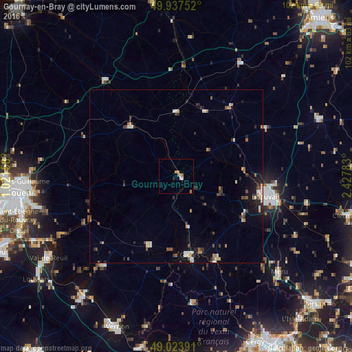
Analysis of Gournay-en-Bray night lights 2016
Square area 10x10 km:
 0.84%
0.84%90-99
0.28%80-89
1.12%70-79
0.56%60-69
1.12%50-59
0.56%40-49
0%30-39
0%20-29
0.56%10-19
0%0-9
94.96%Square area 50x50 km:
0.36%90-99
0.48%80-89
0.31%70-79
0.34%60-69
0.38%50-59
0.41%40-49
0.38%30-39
0.52%20-29
0.9%10-19
1.63%0-9
94.28%Clear (daylight) street map image can be seen on geolist.org.
Map coordinates:
49° 56' 15.1" North, 1° 1' 17.7" East
49° 28' 58.3" North, 1° 43' 29" East
49° 1' 26.1" North, 2° 25' 40.2" East
Some cities around Gournay-en-Bray sort by population:
• Beauvais
26.5 km =16.5 mi,  101°
101°
• Méru
40.6 km =25.2 mi,  133°
133°
• Gisors
22.7 km =14.1 mi,  169°
169°
• Les Andelys
34.8 km =21.6 mi,  220°
220°
• Darnétal
41.6 km =25.8 mi,  264°
264°
• Le Mesnil-Esnard
42.6 km =26.5 mi, 259°
• Magny-en-Vexin
36.7 km =22.8 mi, 172°
• Neufchâtel-en-Bray
34.6 km =21.5 mi,  323°
323°
3015509 (p: 6,449)
Sources (retrieved 2019-11-25):
» Earth at Night: Flat Maps 2012, 2016