Eu night lights from space
Night Light of Eu (Normandy) from space (France) Src. Average luminocity for 10x10km area is 25.8249% and for 50x50km: 4.387%.
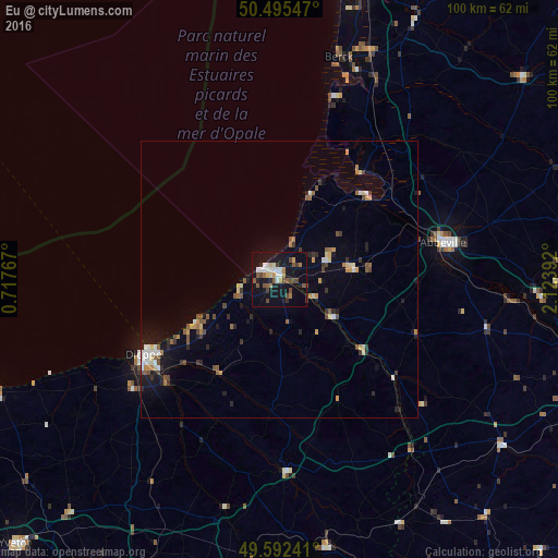
Analysis of Eu night lights 2016
Square area 10x10 km:
 3.64%
3.64%90-99
4.2%80-89
1.68%70-79
1.68%60-69
3.36%50-59
4.9%40-49
5.88%30-39
1.54%20-29
2.38%10-19
36.69%0-9
34.03%Square area 50x50 km:
0.4%90-99
0.56%80-89
0.43%70-79
0.48%60-69
0.59%50-59
0.69%40-49
0.79%30-39
0.52%20-29
0.73%10-19
3.21%0-9
91.6%Clear (daylight) street map image can be seen on geolist.org.
Map coordinates:
50° 29' 43.7" North, 0° 43' 3.6" East
50° 2' 45.8" North, 1° 25' 14.8" East
49° 35' 32.7" North, 2° 7' 26.1" East
Some cities around Eu sort by population:
• Dieppe
28.2 km =17.5 mi,  240°
240°
• Abbeville
30.3 km =18.8 mi,  77°
77°
• Berck-Plage
41.4 km =25.7 mi,  14°
14°
• Berck
41.4 km =25.7 mi,  17°
17°
• Le Tréport
3.6 km =2.2 mi,  295°
295°
• Neufchâtel-en-Bray
34.8 km =21.6 mi,  177°
177°
• Cucq
50 km =31.1 mi, 16°
• Saint-Valery-en-Caux
53.1 km =33 mi,  247°
247°
3019329 (p: 8,425)
Sources (retrieved 2019-11-25):
» Earth at Night: Flat Maps 2012, 2016