Montaigu night lights from space
Night Light of Montaigu (Pays de la Loire) from space (France) Src. Average luminocity for 10x10km area is 11.3878% and for 50x50km: 6.44%.
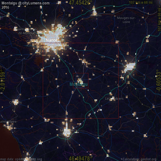
Analysis of Montaigu night lights 2016
Square area 10x10 km:
 0.57%
0.57%90-99
1.14%80-89
1.7%70-79
1.14%60-69
1.28%50-59
2.84%40-49
2.84%30-39
1.56%20-29
1.42%10-19
1.7%0-9
83.81%Square area 50x50 km:
0.97%90-99
1.08%80-89
0.5%70-79
0.79%60-69
0.95%50-59
1.03%40-49
1.08%30-39
0.98%20-29
1.53%10-19
2.13%0-9
88.96%Clear (daylight) street map image can be seen on geolist.org.
Map coordinates:
47° 27' 15.3" North, 2° 0' 41.7" West
46° 58' 36" North, 1° 18' 30.5" West
46° 29' 41.2" North, 0° 36' 19.2" West
Some cities around Montaigu sort by population:
• Vertou
24.6 km =15.3 mi,  330°
330°
• Les Herbiers
25.3 km =15.7 mi,  118°
118°
• Vallet
20.9 km =13 mi,  8°
8°
• Saint-Philbert-de-Grand-Lieu
26.1 km =16.2 mi,  284°
284°
• Les Sorinières
25.4 km =15.8 mi,  318°
318°
• Clisson
12.4 km =7.7 mi, 8°
• Haute-Goulaine
26.4 km =16.4 mi,  339°
339°
• La Chevrolière
26.1 km =16.2 mi,  299°
299°
2993092 (p: 5,070)
Sources (retrieved 2019-11-25):
» Earth at Night: Flat Maps 2012, 2016